This trip has been planned for ages, it being my gift to my niece for her 21st birthday. Rather than giving her ‘stuff’, my thinking was that we’d have an adventure instead and make some memories, so we booked a trip with Macs Adventures to walk (part of) the Bavarian Salt Trail, Salzslpemsteig. It was very exciting to finally be setting off!
Overnight in Munich
We initially flew to Munich, staying there overnight. As we’ve both had the good fortune of being here previously we opted to essentially have dinner (at a nice wee Greek restaurant close to our hotel), sleep, enjoy the buffet breakfast in our hotel, and leave, catching the train to Bernau am Chiemsee where we’d overnight before officially starting our walk.
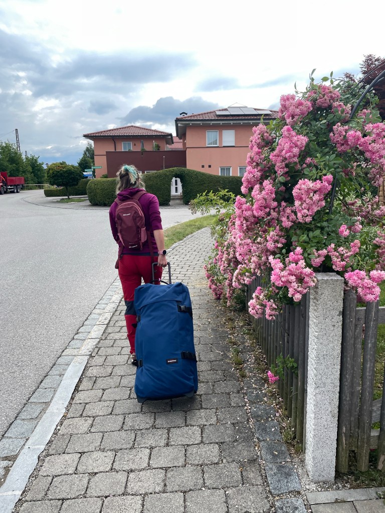
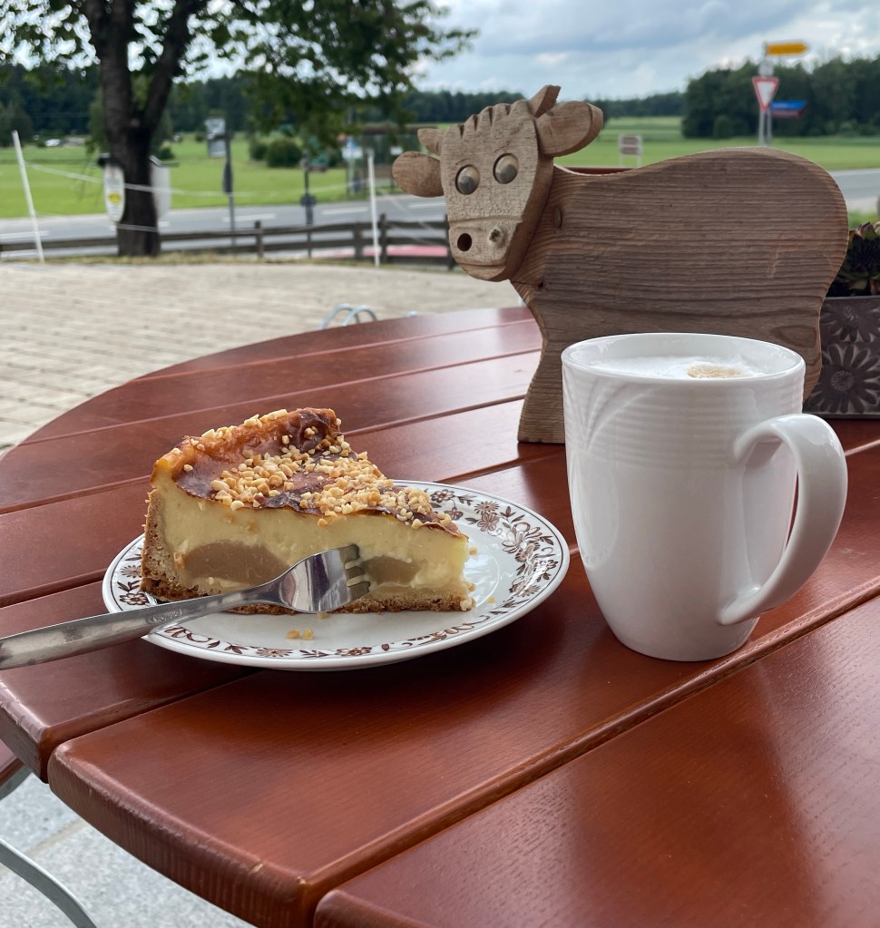
Arriving at the hotel mid-morning, we deposited our bags ahead of heading out in search of coffee. We didn’t have far to go, finding a wee farm café just over the road.
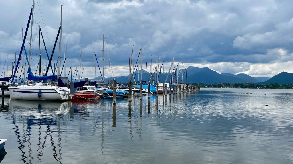
Thereafter, we walked to a lake, stopped for a refreshment and finally found ourselves at Prien am Chiemsee, timing it to perfection as the heavens opened and the rain poured down! Little did we know this would be the theme for the week.
Thankfully the train station had some cover and by the time we reached our stop the worst of it had passed.
Day 1: Bernau am Chiemsee to Marquartstein
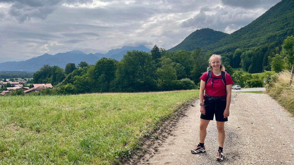
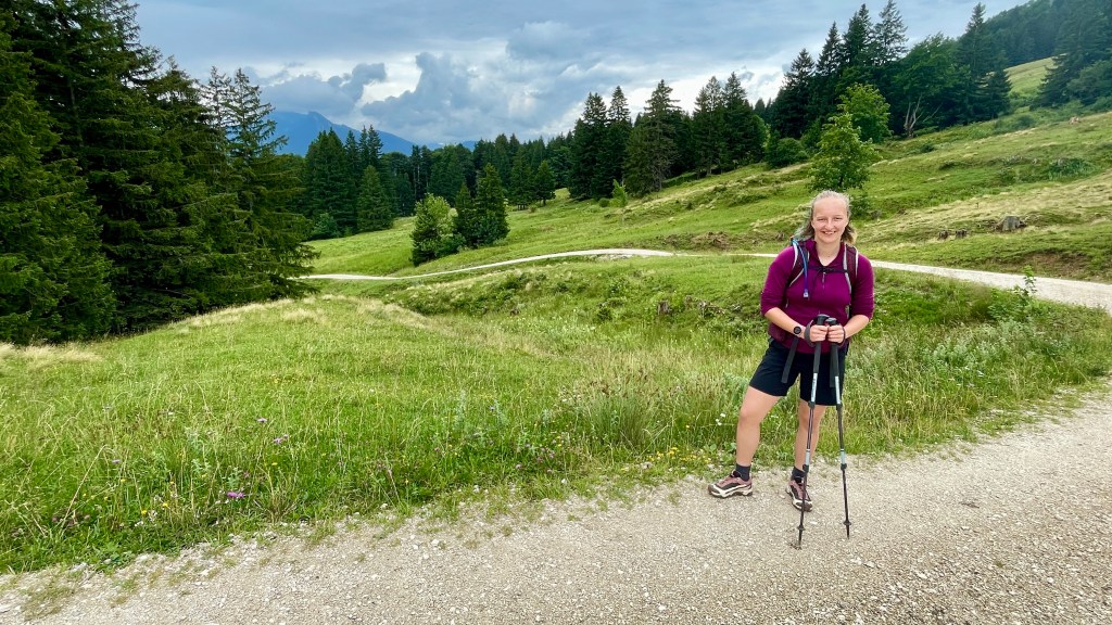
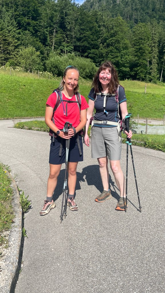
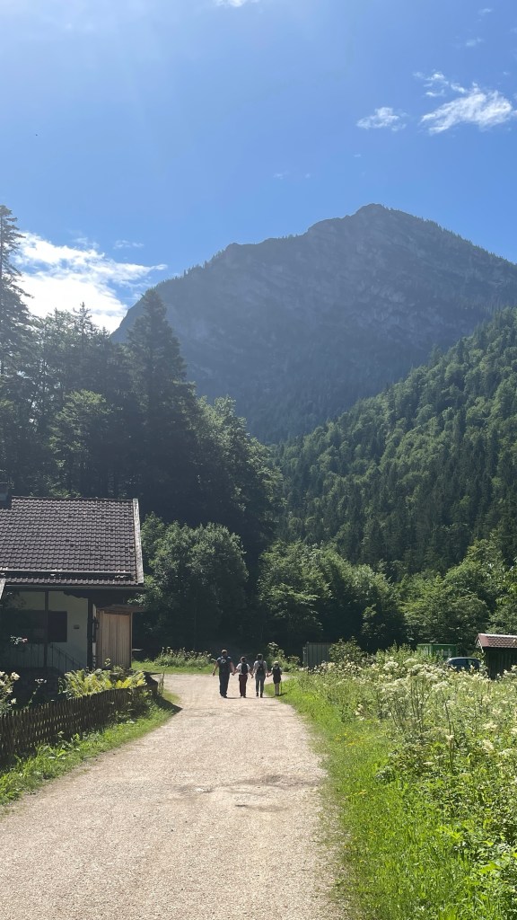
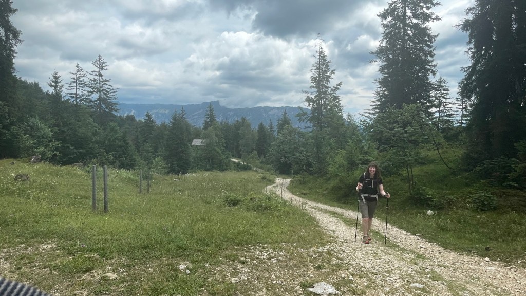
The first official day of our walk saw us up for breakfast refreshed and raring to go. Bags ready for 9 am pick up, we sorted ourselves out and headed our way after a bit more faffing. Staying slightly outside Bernau am Chiemsee, we figured we’d walked the start of the route yesterday, so headed back up past the farm café to pick up where we’d left off.

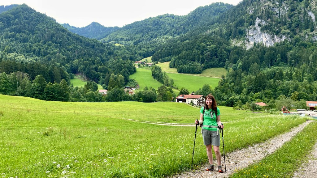
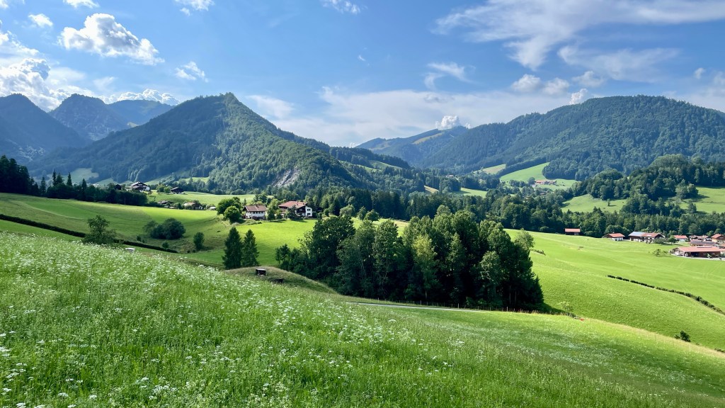
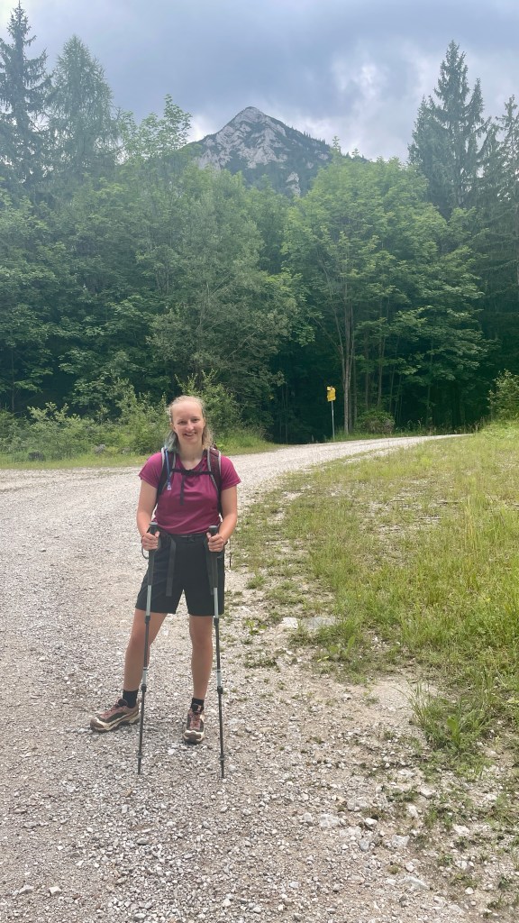
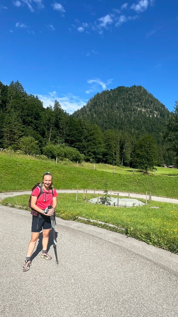
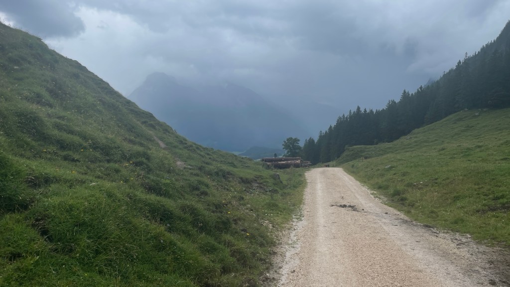
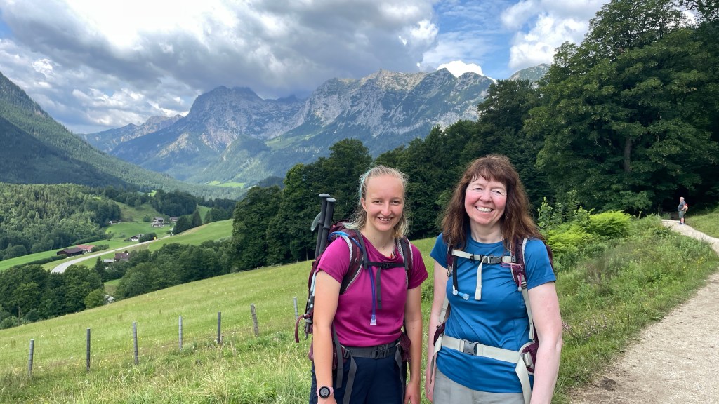
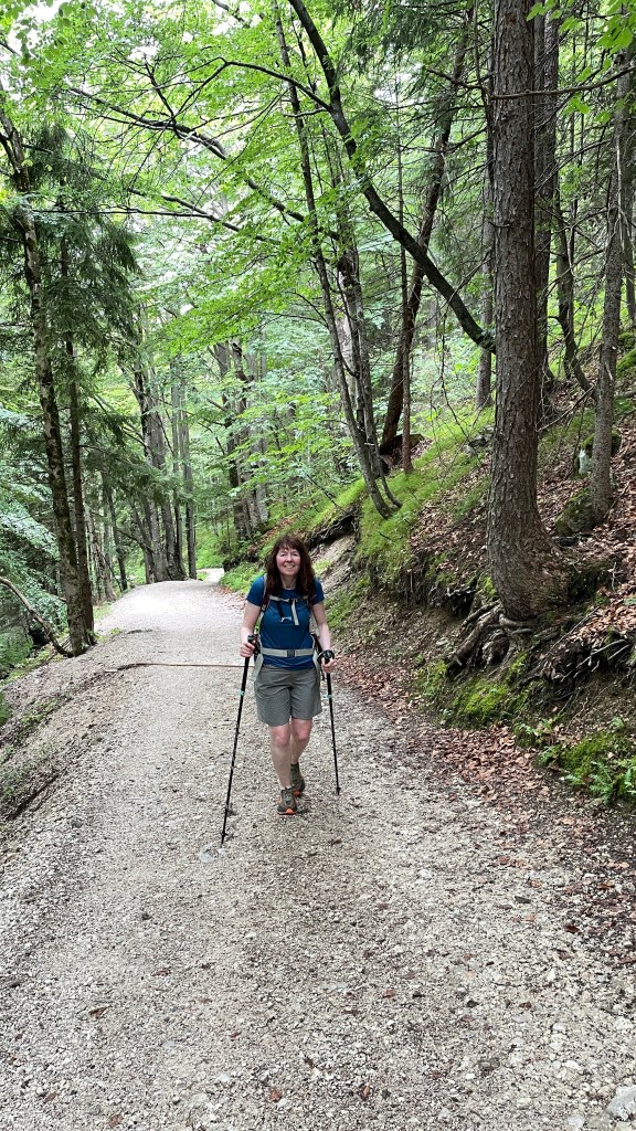
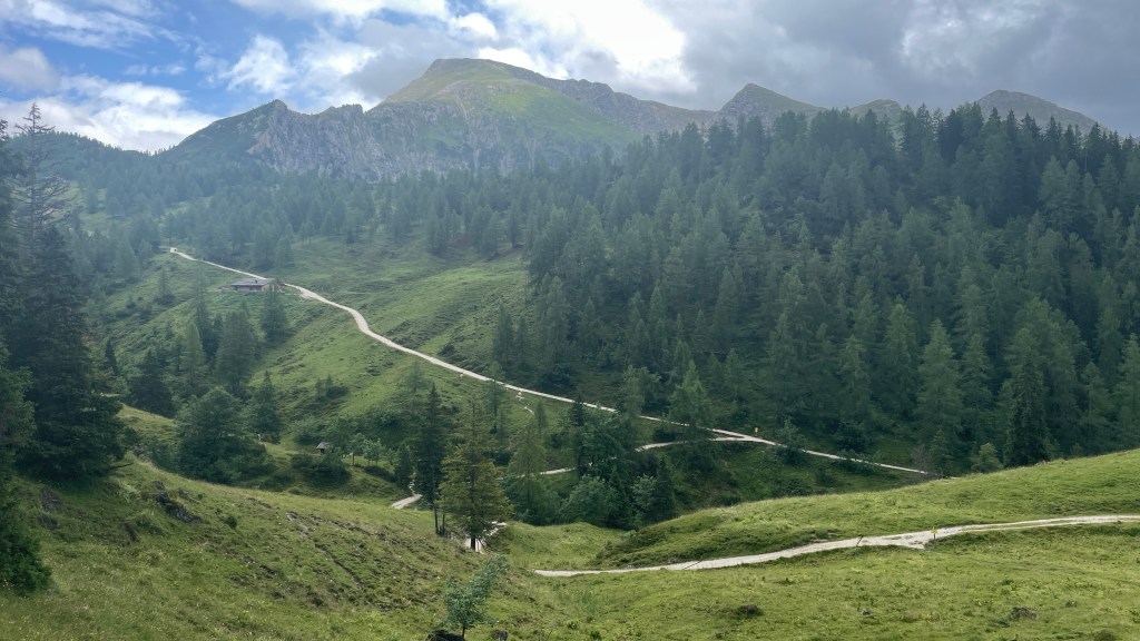
Initially we followed a minor road, very much appreciating the views around us thinking this would be a stunning day. Conditions were perfect for walking, pleasantly warm but not yet too hot.
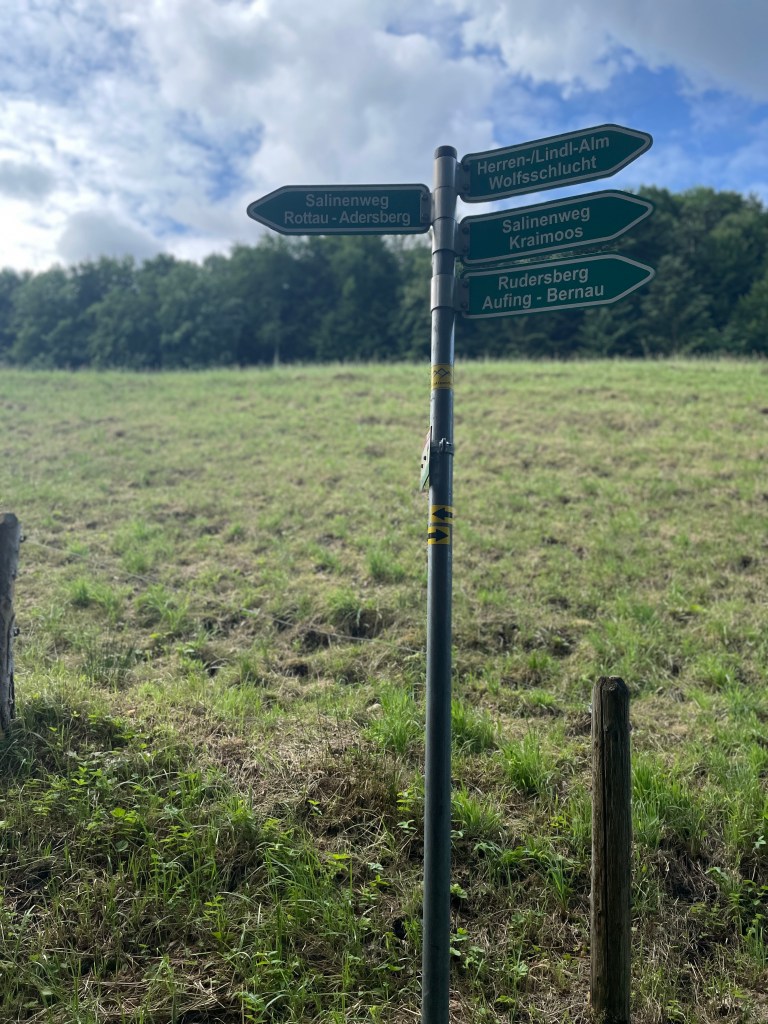
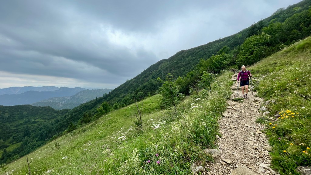
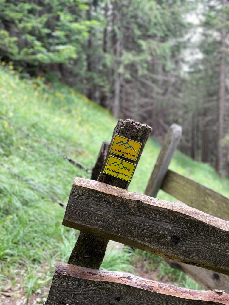
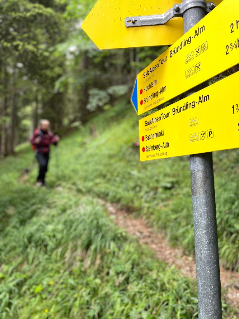
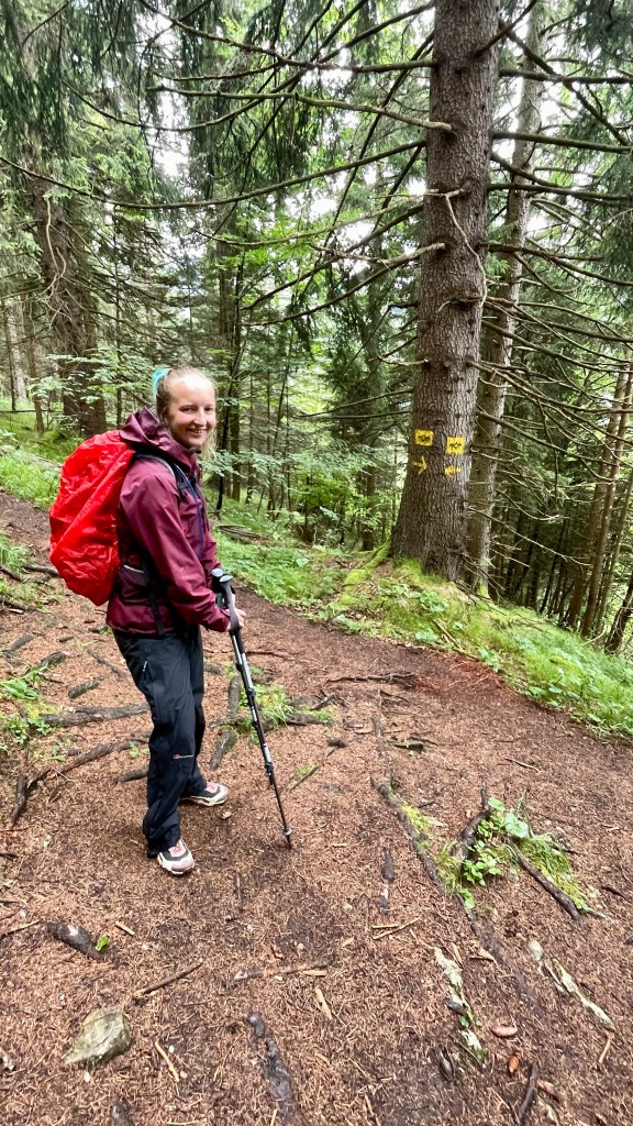
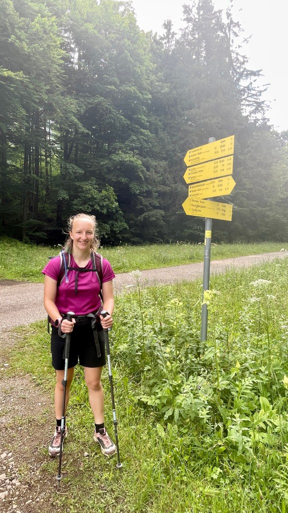
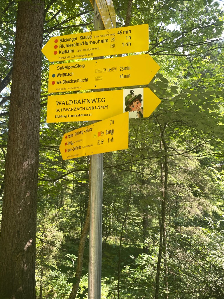
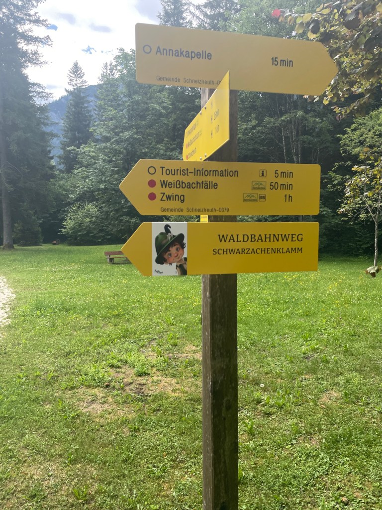
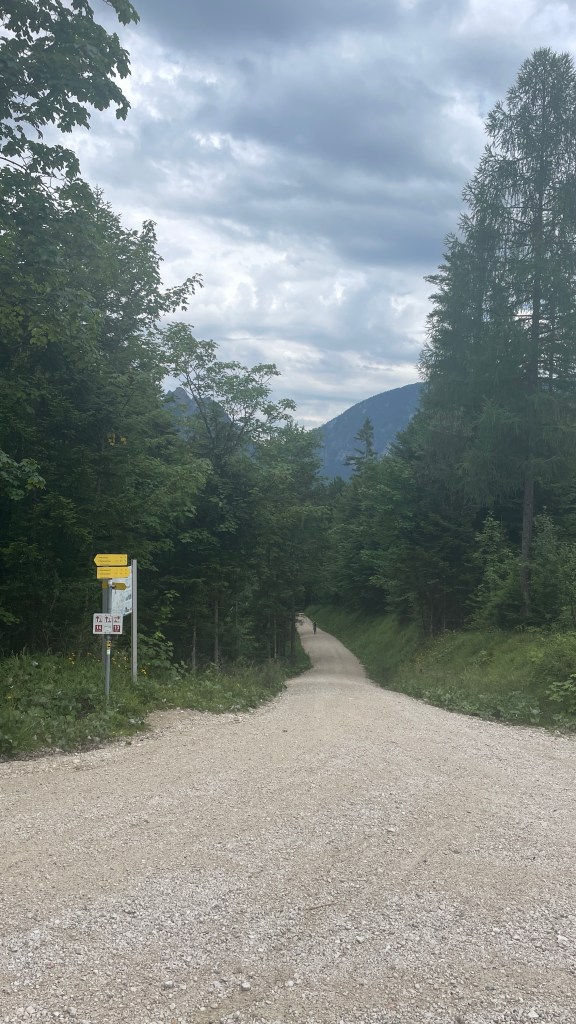
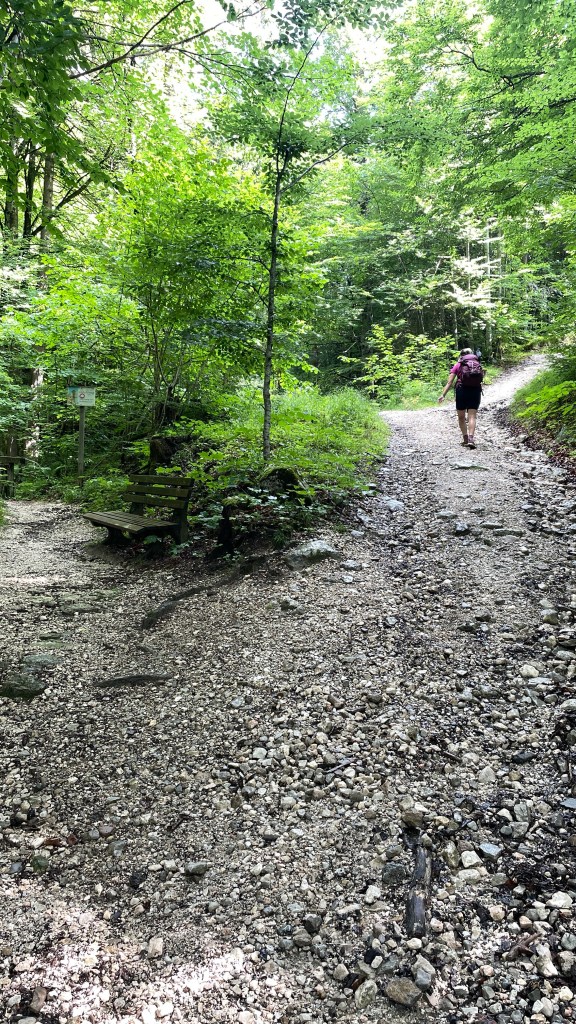
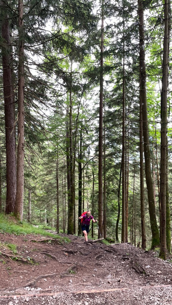
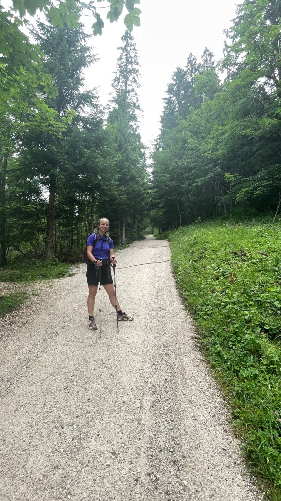
We left the hard surface and headed onto trail which was more pleasant underfoot and this continued for the majority of the day. Signage was good, although we were glad of the Macs Adventures app as it gave us clear mapping and kept us on track at any moments of doubt.

Having gently ascended from the off, we crossed a waterfall, barely more than a trickle, and continued up.

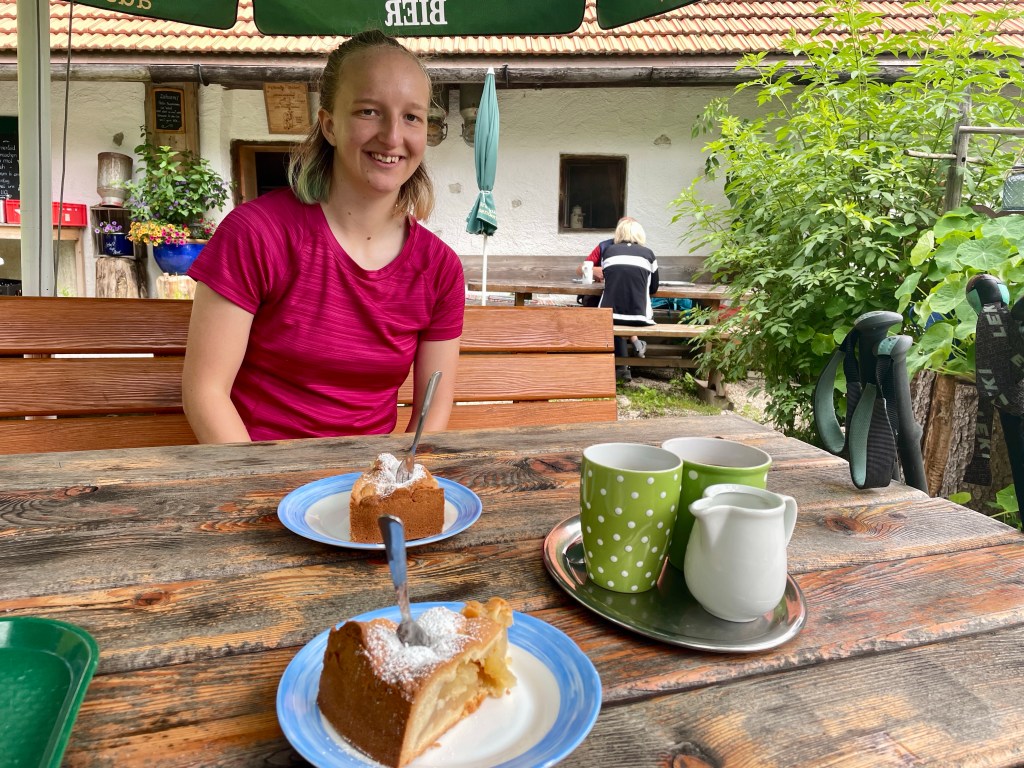
Beyond this we found our first stop of the day, a wee café where we topped up our energy with some delicious apple tart and coffee.
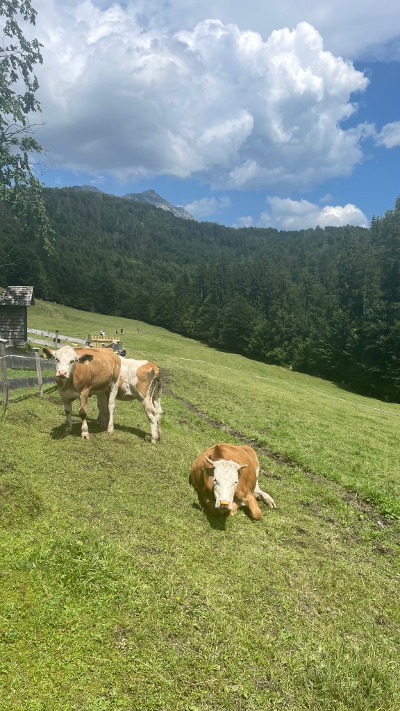
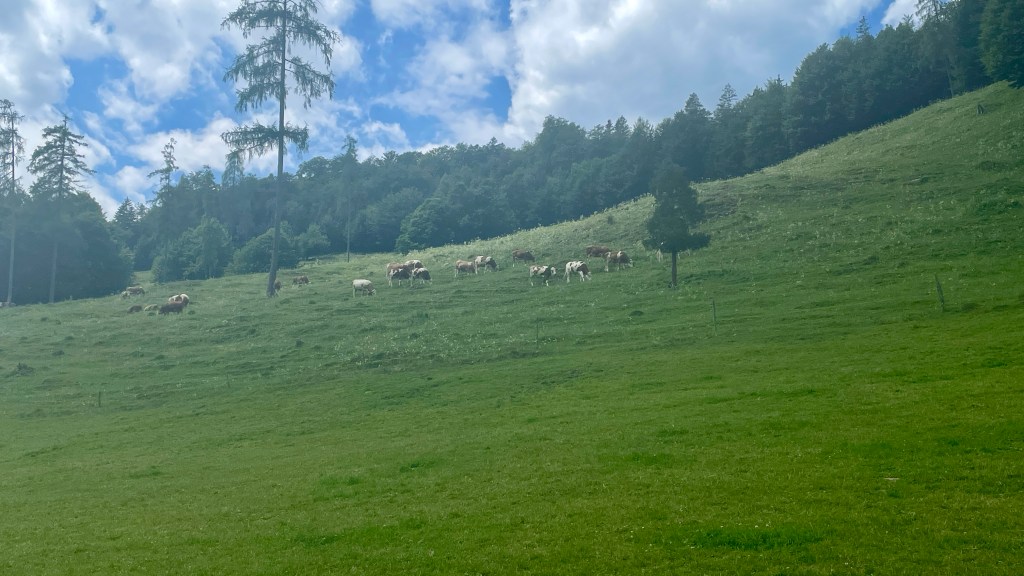
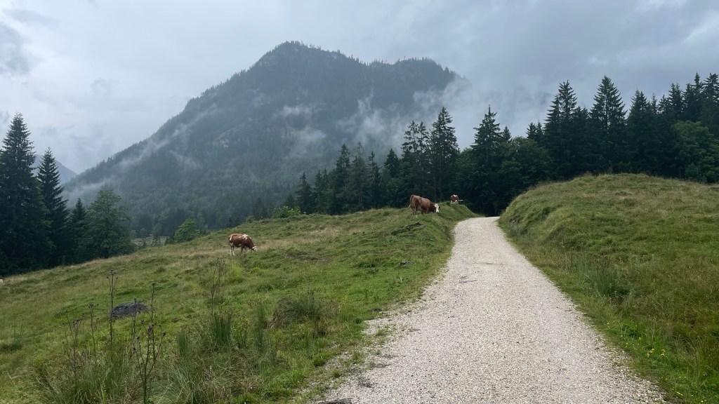
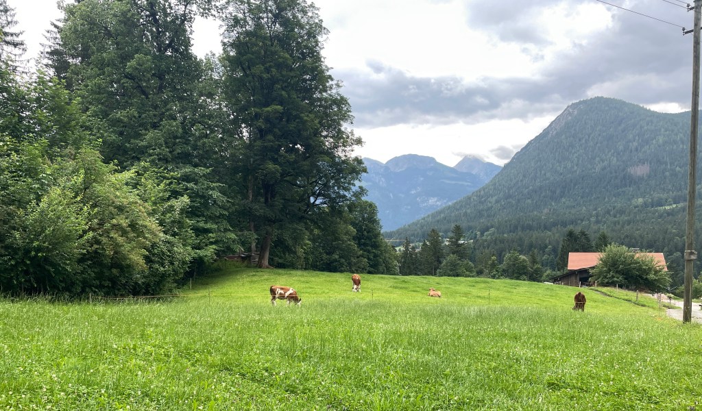
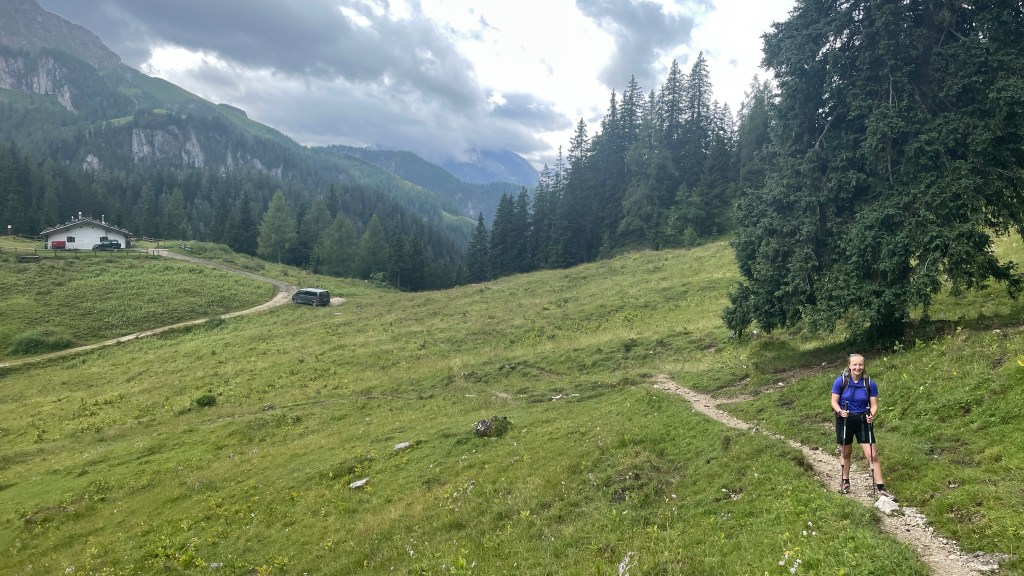
Continuing on, we had moments of reprieve where the ground flattened out and the gradient eased for a time. We heard the distinct sound of cowbells, a lovely background noise throughout the day.

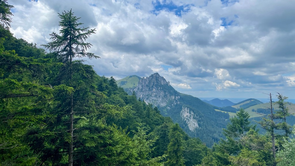
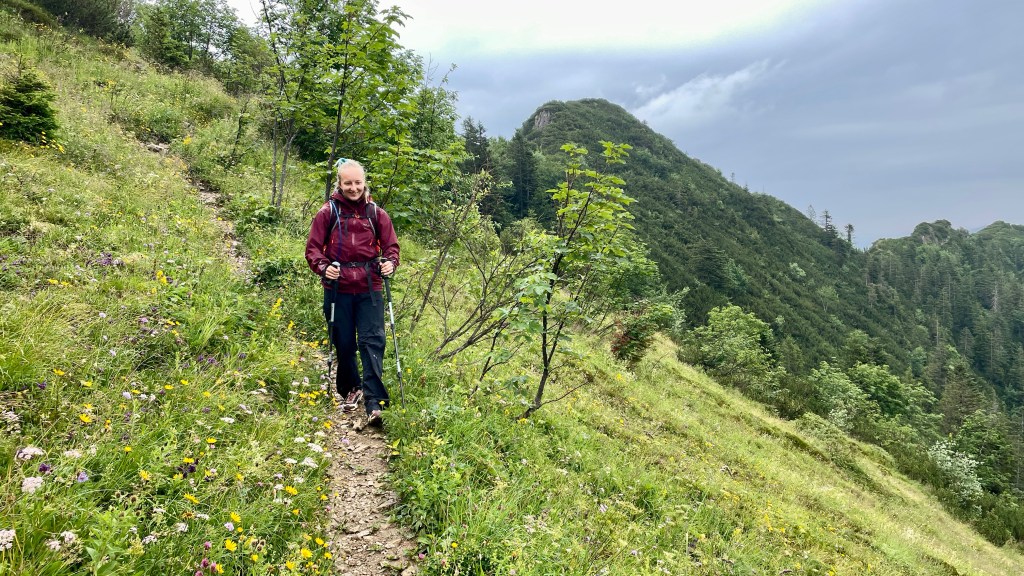
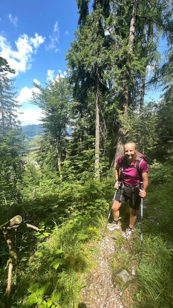
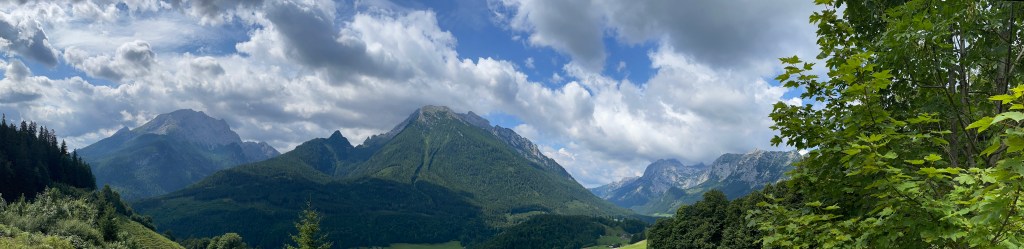
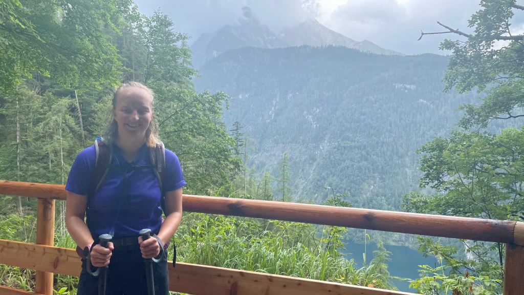
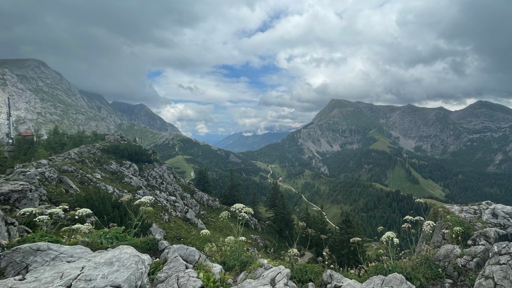
I marvelled at the views, very much enjoying the lush green of the Bavarian countryside.
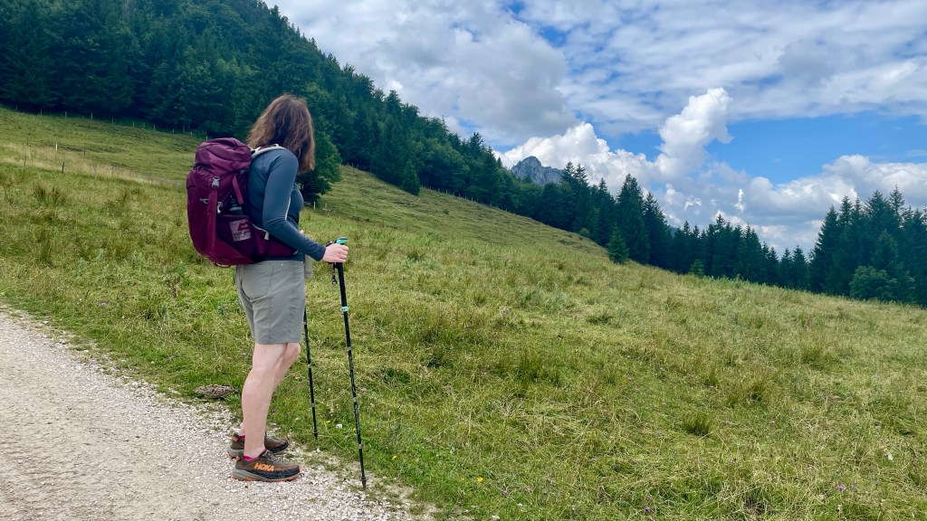

We had the option of looping around a hill, we chose to do this, and enjoyed this little addition to the walk as it afforded us even more beautiful views of the rocky face we’d admired since we started out our day.
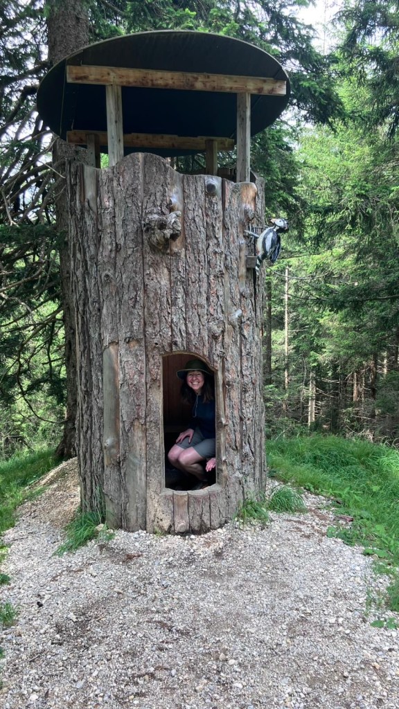
There were also lots of fun things to keep kids (large and small) entertained!
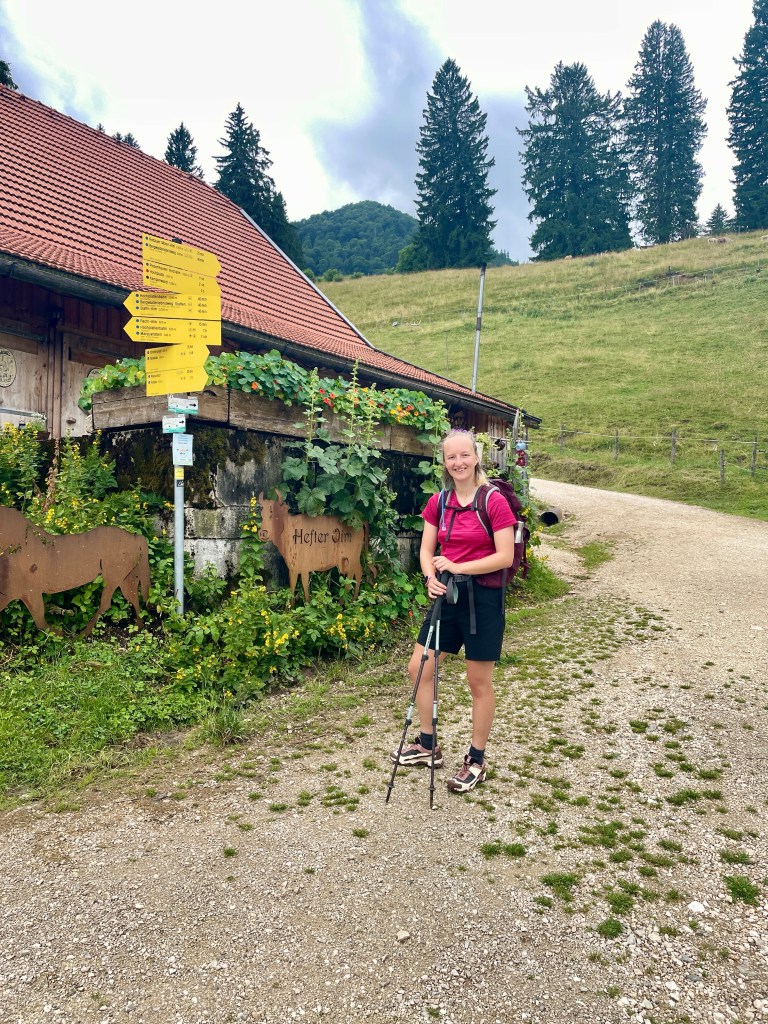
Back on the main trail, we stopped at a busy café, somewhat amazed at the number of people there. It was only on leaving that we realised it was very close to the top of the Hochplattenbahn chairlift! That explained the sudden influx of the masses.

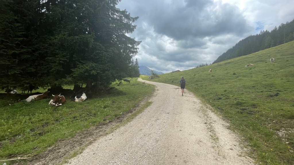
Once again I was very taken by the beautiful cows, incredibly relaxed in their surroundings and not at all phased by us walkers.

I adore the sound of the cowbells! It’s so relaxing.
Finally, having descended steeply at points, we made our way to our final destination for the day.
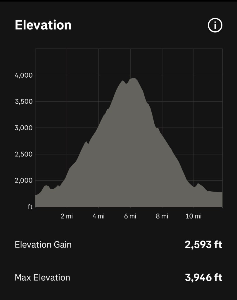
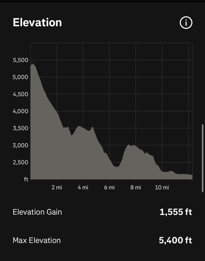
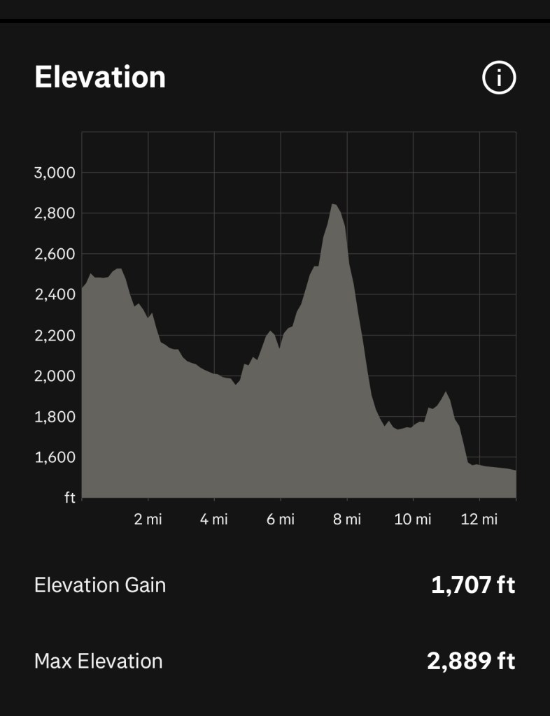
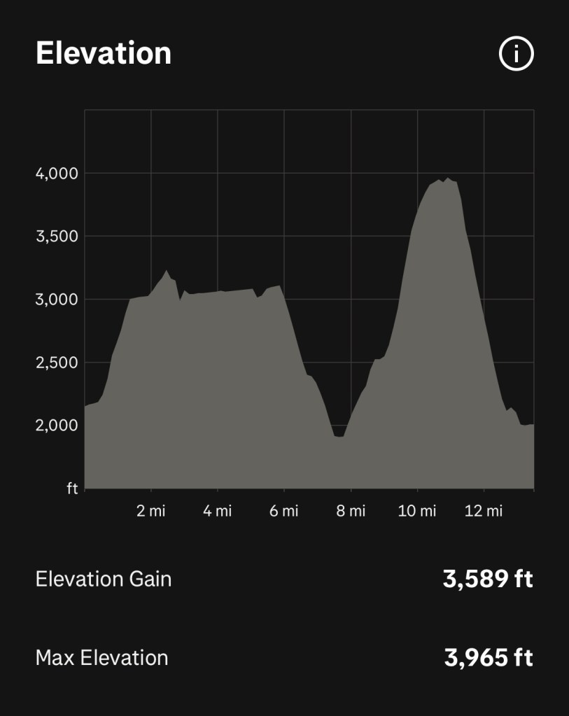
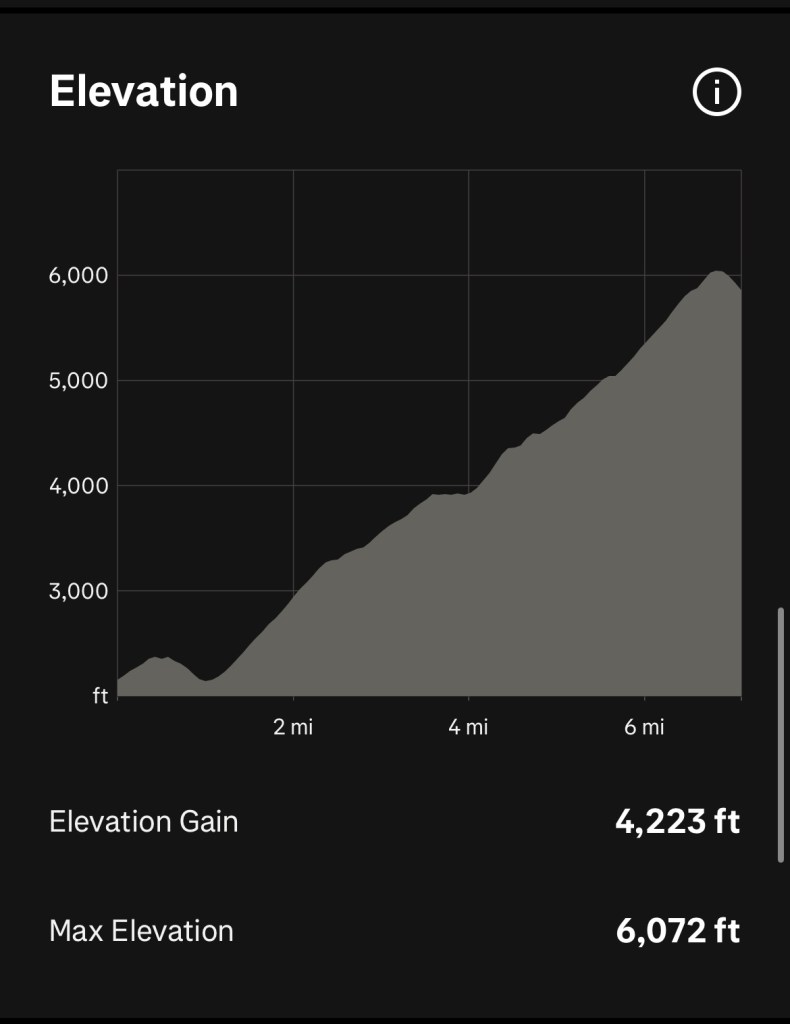
Just shy of 12 miles and a fair bit of elevation! A sterling start.
Day 2: Taxi transfer to Bergen Hochfelln & walk to Ruhpolding
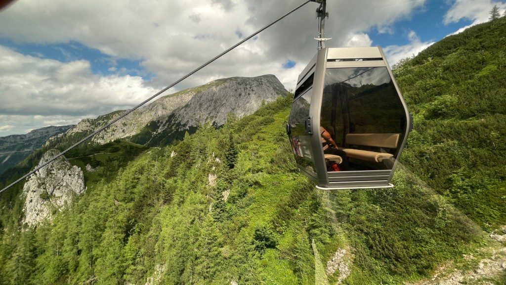
After an amazing breakfast, the beautiful buffet really was a work of art, we took a taxi transfer to Bergen Hochfelln to catch the cable car up the mountain. I was a tad apprehensive about this, but once we got going it was grand. It did amuse me that it was due to depart at 09:30, and the gates were closed, driver ready, doors closed but we waited until the minute hand clearly clicked for half past before heading off immediately. German efficiency at its best!
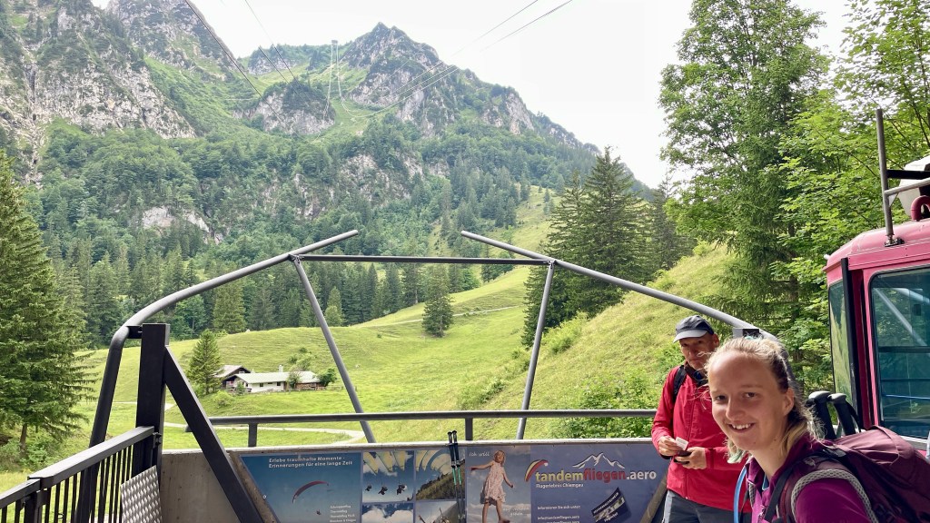
A short ride up to the middle station, we changed to another cable car and headed up to the top. The forecast being for sunny showers, we were delighted to be met with clear skies and beautiful views.


Leaving the summit behind, we found ourselves initially on a wee singletrack path that led steeply down. It wasn’t the best and we hoped it would get better.
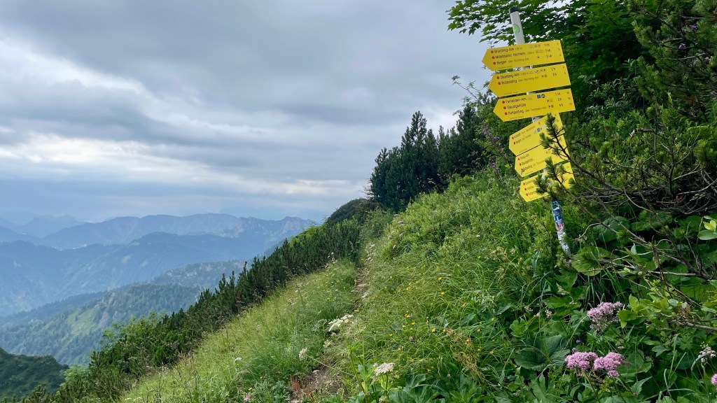
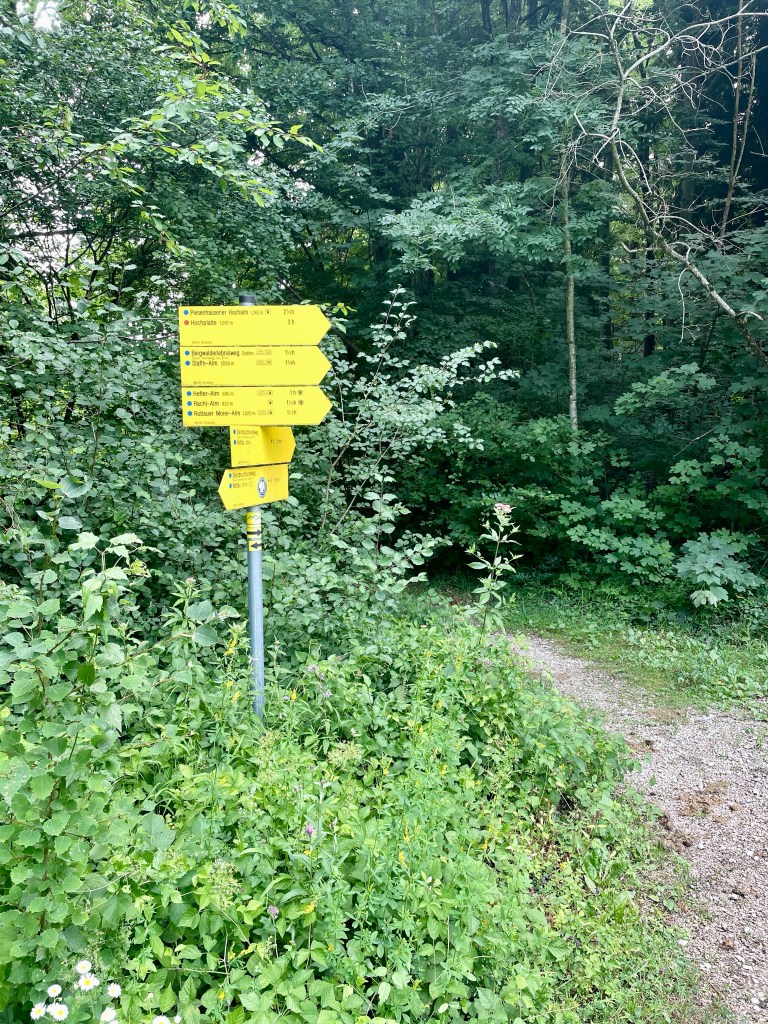
This led to a wider, better path. The signage was good, the yellow and green logo for the route appearing frequently.
We didn’t get too far before feeling a spot of rain. Initially the jackets went on, then we decided to put on trousers too, seeing the ominous dark clouds gathering above and not wanting to risk a soaking.
Before long we were too hot and the shower had passed so we stopped and took the layers off, only for the rain to start again after about 5 minutes. This time though it was so much heavier! We were in a wooded area with some rocky outcrops so managed to shelter from the worst of it. Having waited around 15 minutes to no avail, we gave up, put our trousers back on and trudged on. It wasn’t pleasant walking in pouring rain but it was mild enough; we weren’t completely miserable as we might have been at home where it would likely also be blowing a hoolie!

After a time the worst of the rain did pass, however we were pretty soaked so kept the layers on to try and dry out. We continued to descend, feeling like we should be lower than we were.

The skies clearing gave better views again and the signage continued to be clear. In tandem with the route map on our app, we couldn’t go wrong.

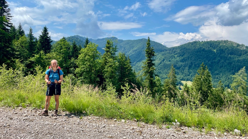
Still well over 1000 metres in height, we marvelled at how much was growing at this altitude. In contrast to the Scottish hills, everything was so lush and green!


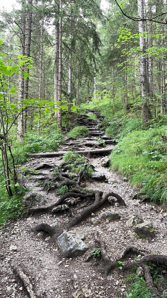
We descended into forest via many singletrack paths. Where these rooty paths would have been easy in dry conditions, we had to watch our footing in the wet.
The app had highlighted a café stop near a waterfall and we were looking forward to coffee. Sadly, we realised beyond the waterfall that we’d missed it, and decided against diverting back up as it had been steep down, continuing on to the next stop instead.

This proved to be a fair way down. In the meantime, other things caught our interest and kept us entertained.

The day brightened up and there were some lovely views to take in.
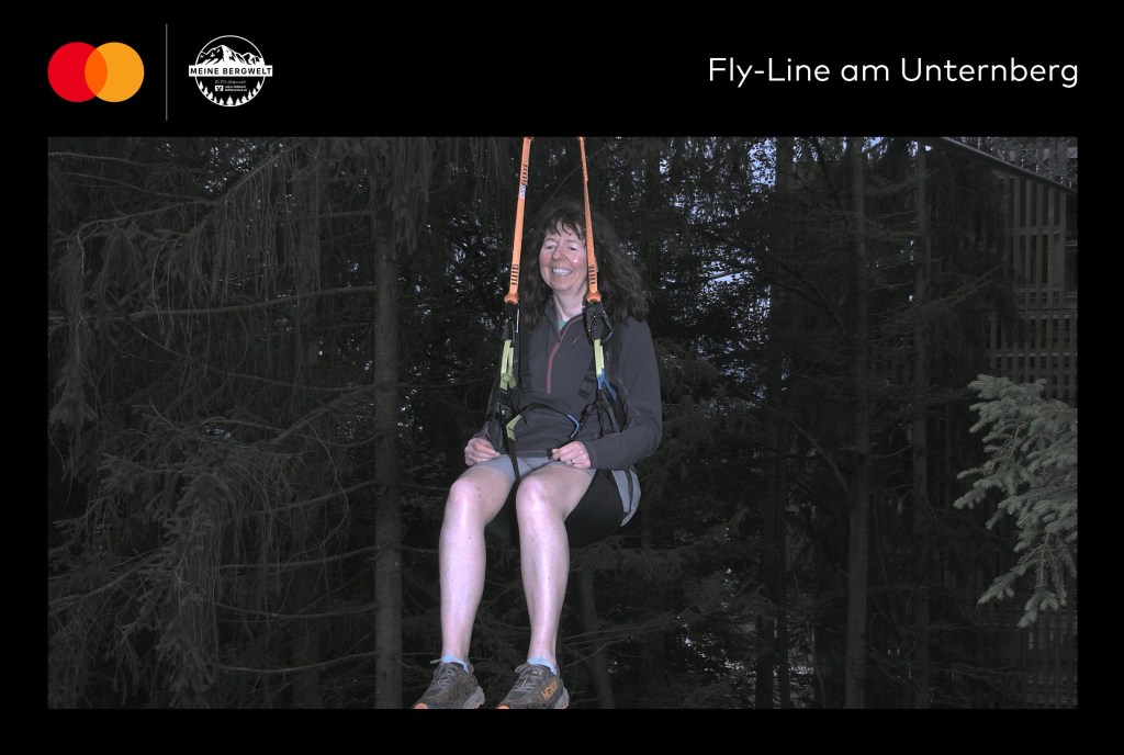
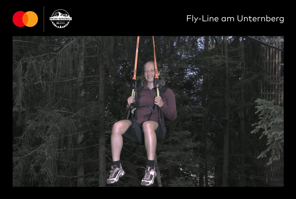
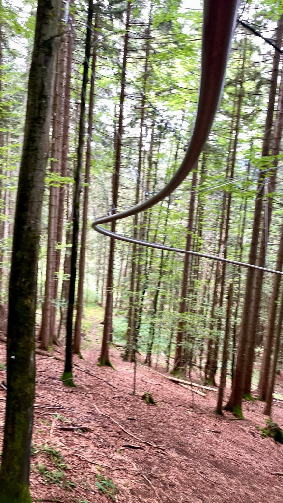
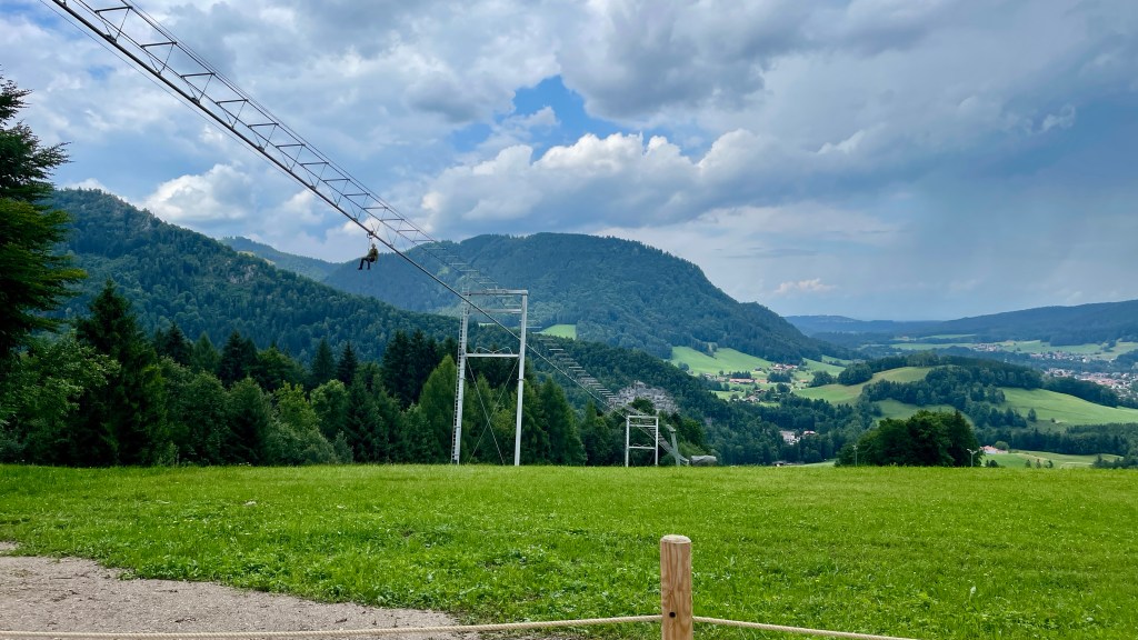
By surprise, we came upon Meine Bergwelt, a fun filled area with a chairlift, rope course and a fly line. We were intrigued by the latter and after chatting to another couple of ladies who advised that it moved at a sedate pace, decided to have a go. Not bad for someone that wasn’t overly thrilled to start the day on a cable car. Ellen, of course, is up for trying anything!
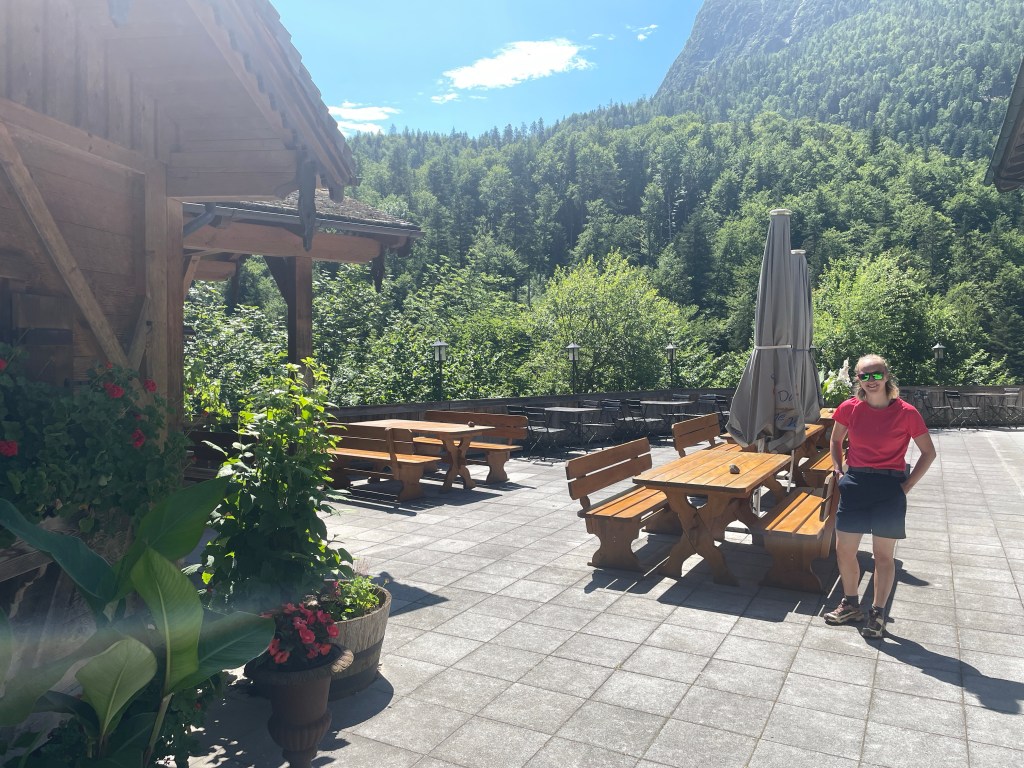
Fun had, we continued on to finally get a coffee and a very fine bit of cheesecake. The views from this stop were amazing!

Suitably refreshed, we began our final descent. Looking back, we could see the high peak where our day had begun. It seemed like a world away in so many senses.
Finally we reached our destination, Ruhpolding, and were able to settle in for the night.
Well fed this week, we walked up to a local restaurant, hot footing it up the hill as the thunder rolled in. We just made it before the rain started tipping down again, only to clear and leave us with beautiful views over the village once more.
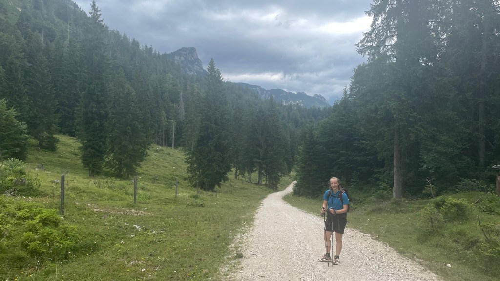
Day 3: Ruhpolding to Inzell
Having realised that we had a shorter day and the luxury of our bags transported by the hotel rather than a faceless taxi company that may turn up anytime after 9 am, we decided to treat ourselves to a slightly later breakfast and a relative lie in. I do so enjoy breakfast on holidays, everything is so beautifully presented and there’s so much choice. I shared my thoughts with Ellen … should I ever win the lottery (I won’t, as I don’t do it), my wish would be to have a personal chef!
Leaving Ruhpolding, I regretted not having the ability to peruse the little shops as they looked intriguing. However, carrying a bird house or a beautiful glass garden ornament on a stick for the day just wasn’t feasible! Instead, we visited the baker and picked up a pastry to provide some sustenance along the way, our route guide advising there weren’t any stops today. The route was, however, much easier and with far less ascent and descent than previous days. Little did we realise how short it was going to be!
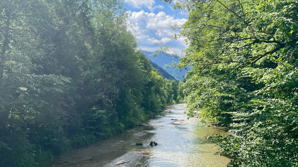
To begin, we retraced the steps we’d taken yesterday, heading towards and then following the river.

We marvelled at the crystal clear water; had this been the end of the day we’d definitely have been in it! The sun was out and it was feeling very warm!
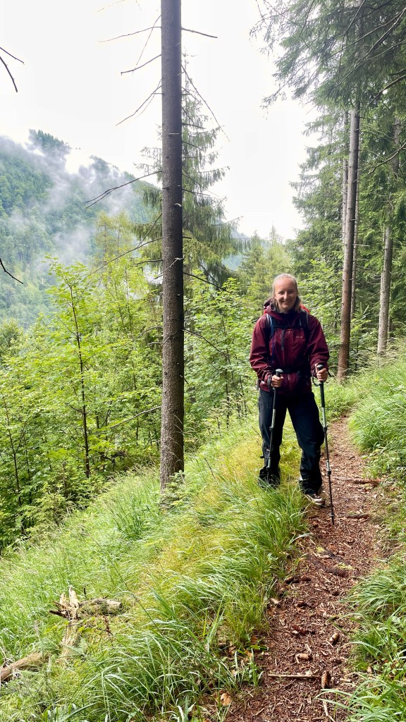
As we continued, we very much enjoyed the sections of forest, again getting a reprieve from the heat of the sun in the coolness of the trees.
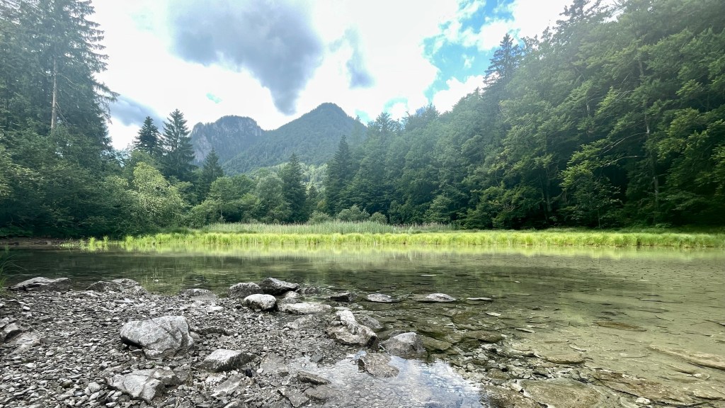
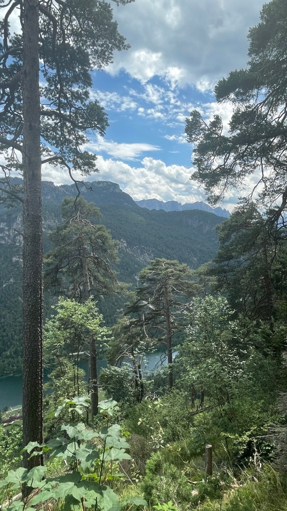
We stopped briefly at a lake, again beautifully clear with the mountains reflected in the water.
Leaving this behind, the climb of the day began, heading up a singletrack path, zigzagging to gain height. It made for interesting walking and our calves felt the effort of the last few days. Before long, we made it to the top and the ground levelled off once more.
Signage was good, although at times we appeared to be following an alternative route with the app. That said, we never got lost.

Views up high were lovely when we could see through the trees.

Aware that we still had a few miles to Inzell, we debated a pastry stop.

Reviewing the map, we decided to hold off until we reached a hotel, get a coffee and eat our snack there.
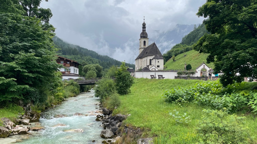
We came upon a wee church, far from anything. The wonders of Google Translate advised that this was originally built for miners in the 16th century, and has had various incarnations to be what it is today. A peek through the window revealed a peaceful sanctuary with small pews and lovely stained glass.


Continuing to the hotel, we stopped for coffee, Ellen then querying where we were staying as the app appeared to suggest this was our hotel! We were both surprised and delighted to find that this was indeed our final location for the day, the last mile and a bit to Inzell not being required.
A lack of buses and a lack of desire to walk to Inzell and back saw us enjoy a very relaxing afternoon with books and a sauna. Bliss! Refreshed and recharged, we’re good to go again tomorrow.
Day 4: Inzell to Bad Reichenhall
Today we experienced true German efficiency. Our itinerary states that our bags will be picked up at 09:00 and dropped off by 17:00. We’ve largely been earlier than this in arriving at our accommodation and our luggage has always been there. This morning, we agreed that we’d take the bags down at 09:00 and leave as it was scheduled to be a longer day. In my usual style, I’d faffed around for longer than planned, so I messaged Ellen, my travel companion, to advise I’d be dropping my bag and returning to my room. Having done so and then gone to request a refill for my water bladder, the lady at reception came looking for me. It was 09:02 and the taxi driver was awaiting the second bag. Thankfully he appeared amused by it and was not concerned about the three minute wait he’d incurred. Lesson learned for tomorrow!
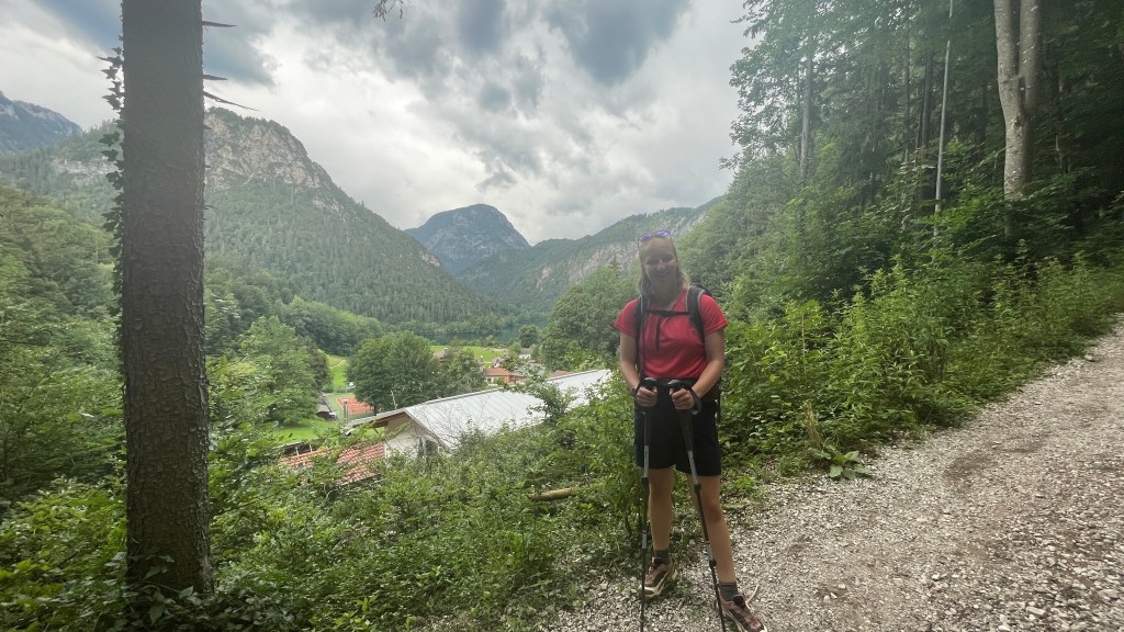
All set, we headed off for the day. This saw us cross the road to reach the trail outside our hotel. A fine, easy start to the day.

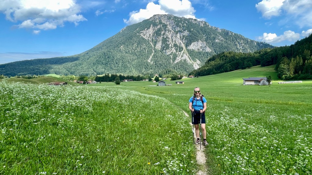
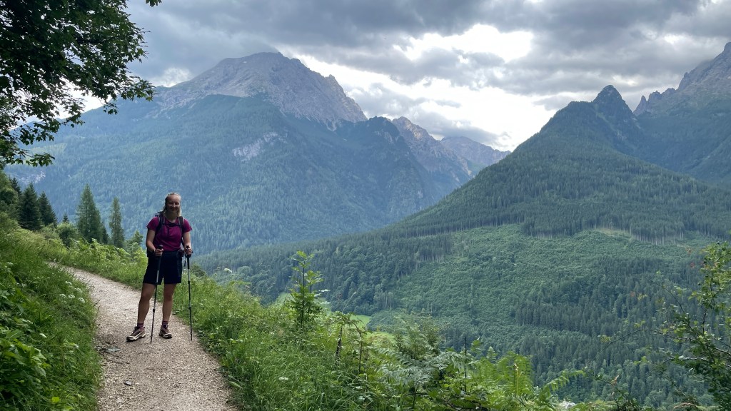
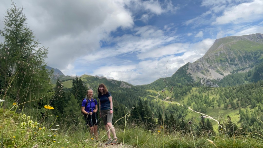
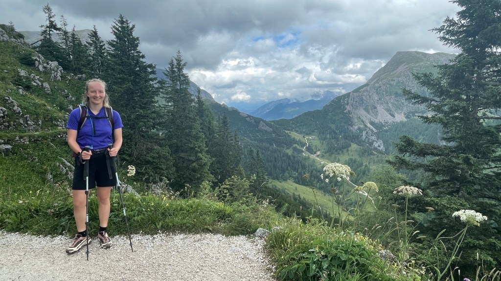
The mountainous scenery was stunning. We stopped for a photo and I got a great shot of Ellen having had someone take a as picture of the two of us and completely miss the point.
Avoiding a busy road (thankfully as I still haven’t quite got my head around which direction the cars are coming from) we went through an underpass.

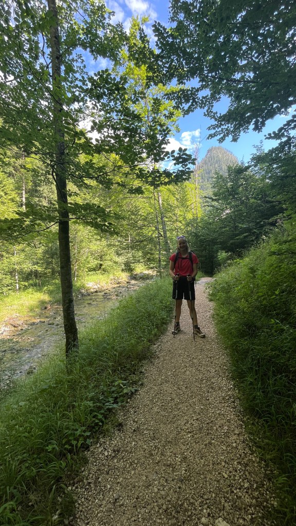
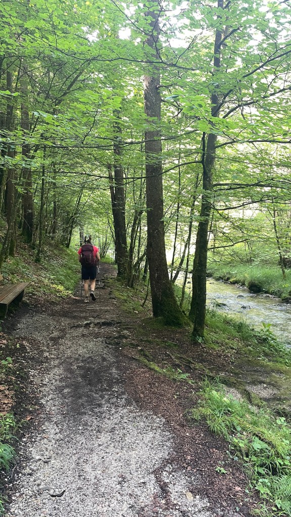
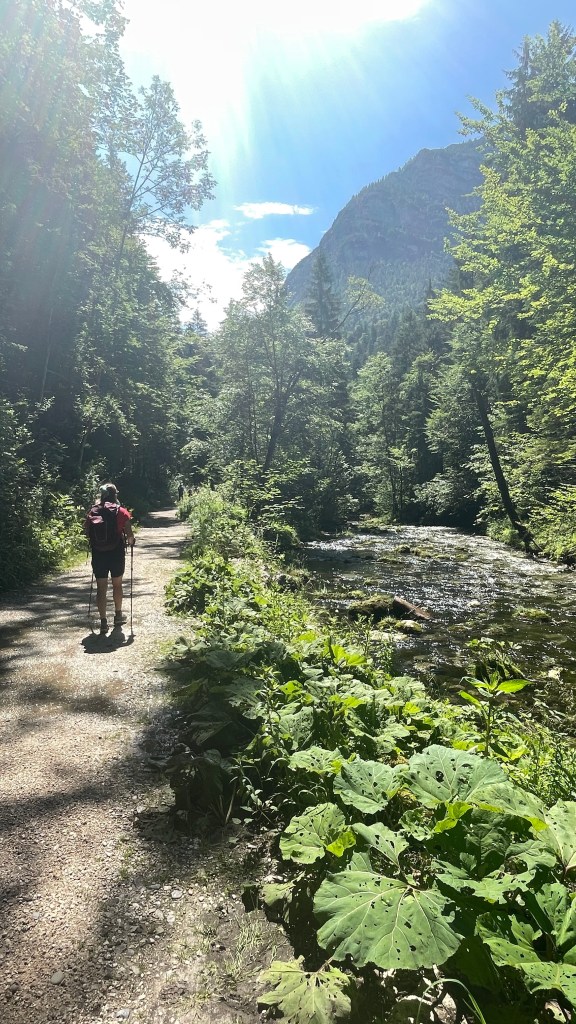
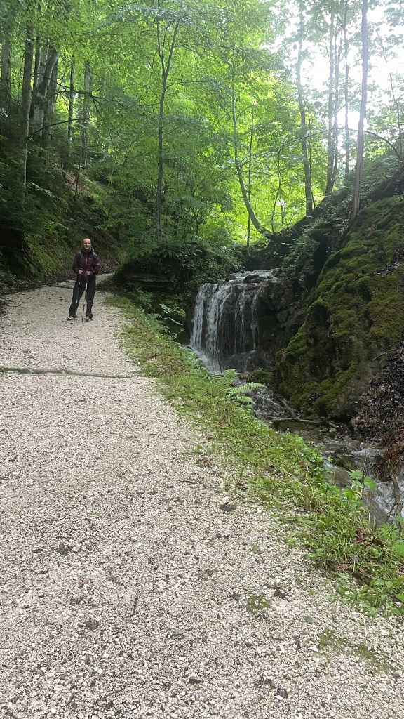
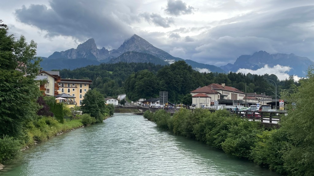
Thereafter, we followed the river for quite some time. It was so clear and refreshing to walk through the coolness of the trees.
We took some steps down to view a waterfall.

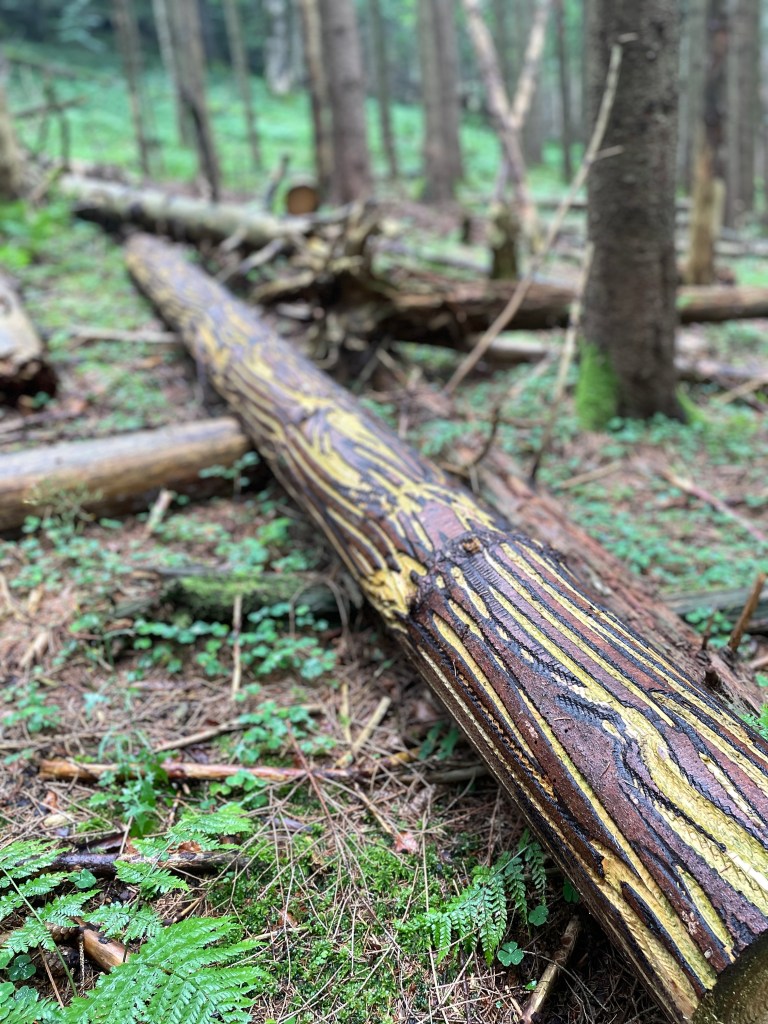
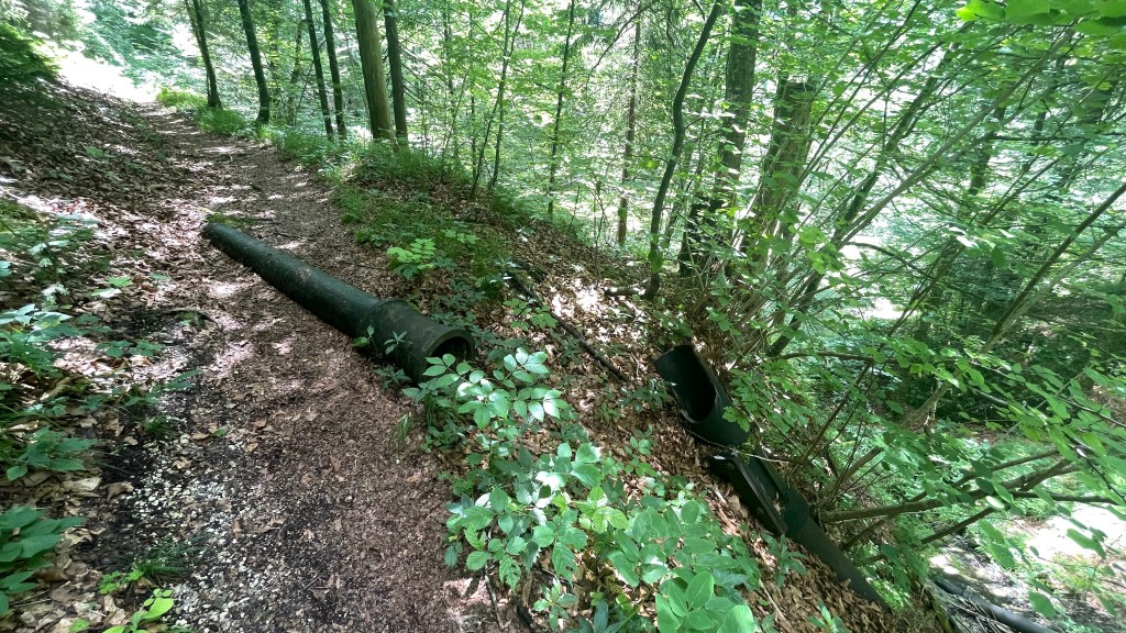
As we continued there was evidence of the old brine pipelines.

The path continued to follow the river and we enjoyed the easy walking and stillness (for the most part).

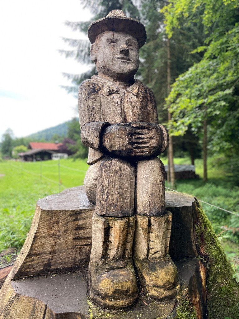
There appear to be many way marked trails. I’m particularly intrigued by the wee miner on the signs.


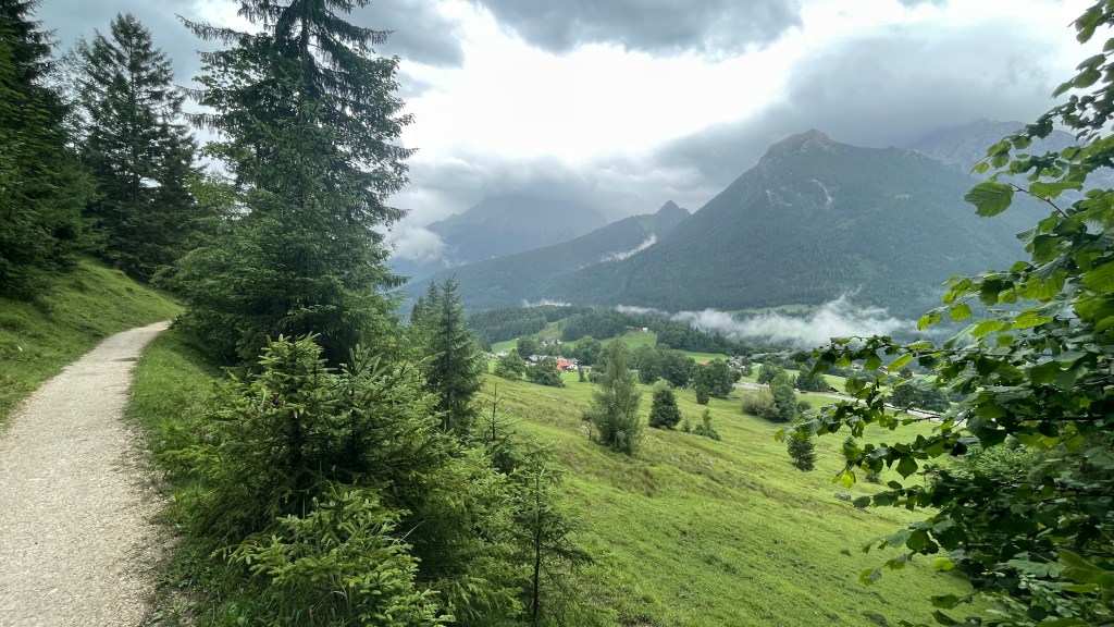
Once again we were spoiled with beautiful views and peeks of big mountains on the horizon. We stopped for a snack at a lovely sheltered bench feeling it would be rude just to pass by.
We passed through a little village and marvelled at how wonderful it must be to live somewhere with these spectacular views on your doorstep.


The sun was out and it got very warm in areas where we did not have the shade of the trees.
We were delighted when we came upon a hotel for a stop, and even more delighted when they served us coffee and apple strudel despite us being ahead of their midday opening.
It was very hot by the time we left. Heading off, we had to double back on ourselves to find yet another underpass.

It didn’t take much to persuade me (or more likely me to persuade Ellen) to stop for a cold drink when we came upon a very busy farm café. It appears that many locals enjoy walking or cycling in the hills on Sunday!

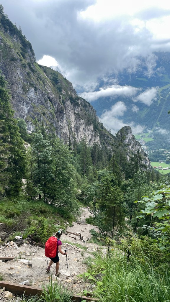
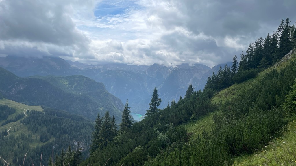
Here, our big climb of the day really began. It was hot! However, we were rewarded with amazing views down to the lake below and to surrounding mountains.

Past the lake, the atmosphere changed. The wind got up and I could feel the pressure in my head, the dark clouds indicating that there was rain coming. Initially it was just a spot, but the spots grew more frequent. As the rain increased and the wind picked up some more, we put on our jackets. A rumble of thunder came, shortly followed by more rumbles and crashes, the rain getting heavier still. This continued for a while, rumbles drawing closer, then thankfully moving away from us.
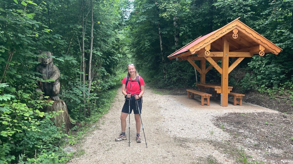
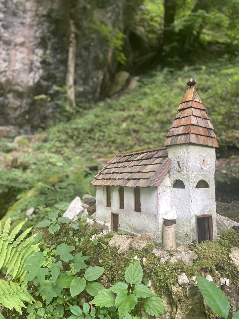
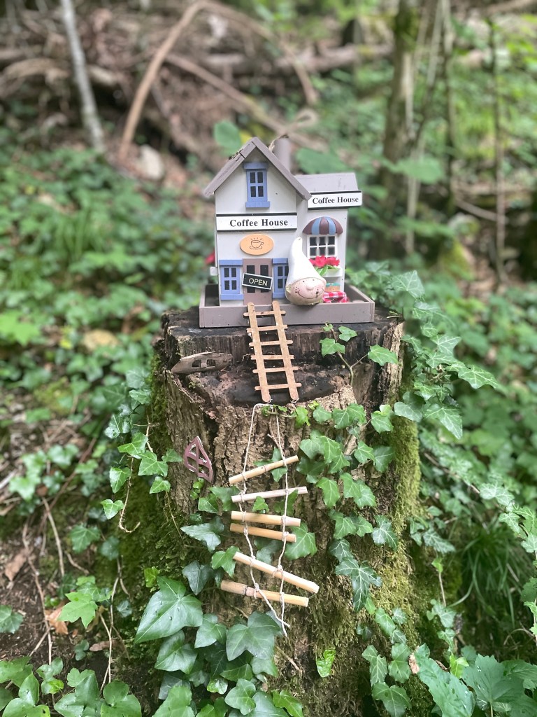
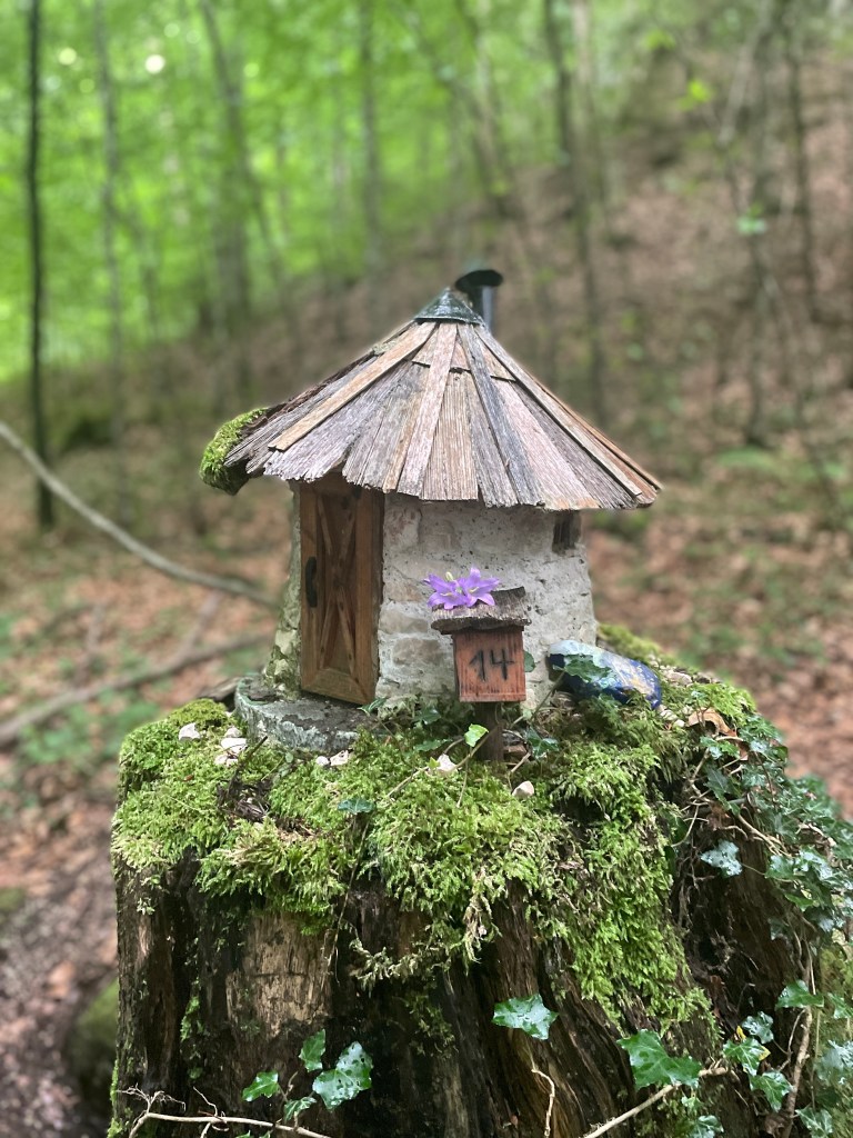
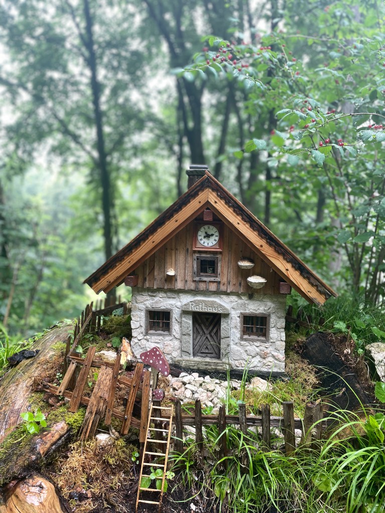
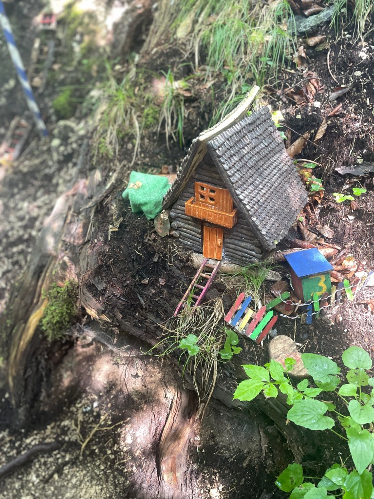
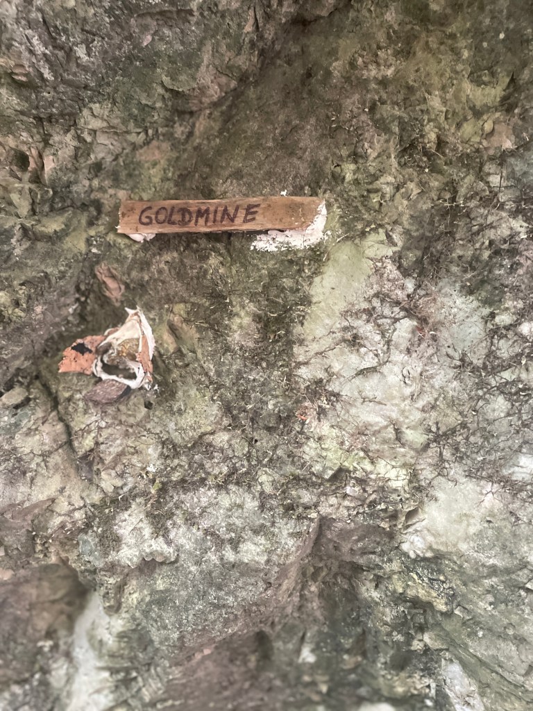
Throughout the thunderstorm, we were following a little trail of houses and buildings through the woods. These were delightful and eased the pain of walking in the heavy rain. These are a few of my favourites:


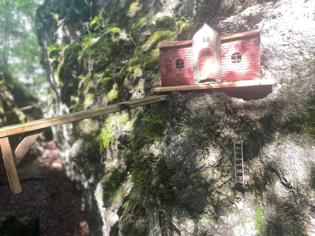
As quickly as the rain had started, it dried up and the sun broke through once again, reverting to a beautiful day! This afforded us a lovely view of Bad Reichenhall in the distance.

We finally made it, just over 13 miles for the day.

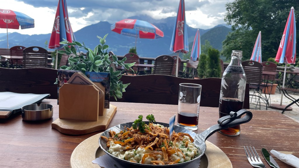
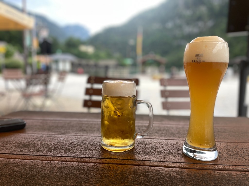
Our evening reward was pizza al fresco, a refreshing change from schnitzel.
Day 5: Bischofweisen to Ramsau
We caught the bus from Bad Reichenhall to Bischofweisen to start our day. Having been slightly aggrieved at having to pay a few Euros for a guest card last night, it turned out this was a good thing as it gave us free bus travel throughout the day!
Ellen had managed to suss out the bus last night – I’d have been getting on at the wrong side of the road – and we were there ahead of schedule to be safe. No issue though, it arrived bang on time. Ahead of the bus arriving the rain came and continued as we drove to our start point. This being beside a camp site, we stopped off for a drink to allow the shower to pass before beginning our walk.
Initially this took us along a minor road, then leading to a very good track. This made for good walking, gradually gaining height.

Our path changed to a narrower single track for a time. The weather was very pleasant, a little hot in times of direct sunlight, but as with previous days, pleasantly cool in the shade of the trees. The only irritation was the clegs (horseflies) who seemed pretty intent on joining us on our walk.
We continued to climb gradually, looking back to see stunning views.
Making light work of it, chatting as we went, before long we’d conquered the big pull of the day and were headed towards the highest point of the day at 1200 metres.
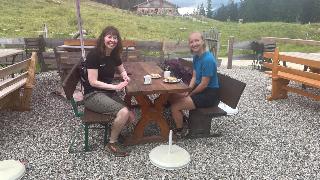
Here we stopped for coffee and cake. It was beautiful on our arrival, but as we sat it clouded over.
Thinking we’d missed the rain, it appearing to have passed nearby, we headed up to the viewpoint to see the high mountains around us. Here the clouds gathered and we had to make a quick run back to shelter again.


The rain easing after a while, we donned our rucksack covers and jackets and began walking in light rain. Others coming up had umbrellas, not something you’d ever see at over 1000 metres in Scotland as they’d blow away! Here, in sharp contrast, there was very little wind.
Sadly the light rain didn’t last too long, instead it became heavier and more persistent, so we stopped and put on the waterproof trousers as well, clammy legs and all.

The mountains that had been so enticing were now shrouded in thick cloud, making them very atmospheric.

Down we went, steadily losing the height that we’d gained, back into the forest where it was hard to determine what was rain and what was run off from the trees.

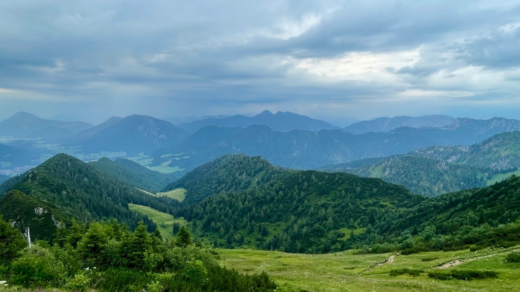
Out of the trees, we enjoyed the views once again, clouds enhancing the mountain landscape.
As we finished our walk, the path steepened to descend to the village, the stream bumping down in miniature waterfalls alongside us.
True to form, as we reached Ramsau the rain ceased and the sun came out again. Perfect timing! We sat outdoors at a little coffee shop to enjoy another coffee and more cake while waiting for the bus. Given that there were two in fairly quick succession, we opted to wait for the second. This also provided an opportunity to get a quick photograph.
In crossing the bridge and getting down lower to cut out the road I thought I’d missed the bus, running back across when I saw it coming. No fear though, German efficiency again, it was early and waited a couple of minutes until bang on time before departing.
Once safely ensconced in Berchtesgaden, all that remained was to explore the locale and wonder at the awesomeness of nature! How lovely to be surrounded by such splendour!

A shorter day today, still with some elevation though. Feeling it slightly in our legs, we opted to take the lift up to our 4th floor bed on retiring for the night.
Day 6: Ramsau to Königssee
Billed as the most strenuous day of the walk, we caught the bus from Berchtesgaden to Ramsau where we began our walk. This saw us retrace the route that we’d descended yesterday, but this time we followed the correct route all the way (where yesterday we’d wandered off course just a little).


Before long we’d picked up some decent height and came to the first potential stop of the day. Still very much refreshed after breakfast we continued on, chatted too much, missed a turning and ended up having to go cross country very briefly to right ourselves. We could easily have continued on the path we were on and joined the route later, but it was preferable to descend to get the views without the tree cover.
The walking was, for the most part relatively easy, having had the initial pull of the day up from the roadside.


We continued on, chatting at our leisure until we reached a stopping point. Feeling like I’ve had enough cake, I opted for Spätzle. Eyes bigger than stomachs, we did our best and in the end were kindly offered take away boxes; sadly they wouldn’t have travelled well in the rucksacks and we lack access to a microwave so we politely declined.
It was at this point that I realised I’d been wearing my t-shirt outside in for the day so I changed it around before heading off.
Refreshed, we were happy to be heading downhill for a time, allowing our food to digest. The skies were becoming moody and we hoped that the rain would continue to dodge us.


Reaching the roadside before heading up again we searched to no avail for a coffee shop to shelter from the imminent rain. Nothing forthcoming, we settled into a bus shelter instead and sat for around half an hour ahead of going when the skies and hills had cleared.
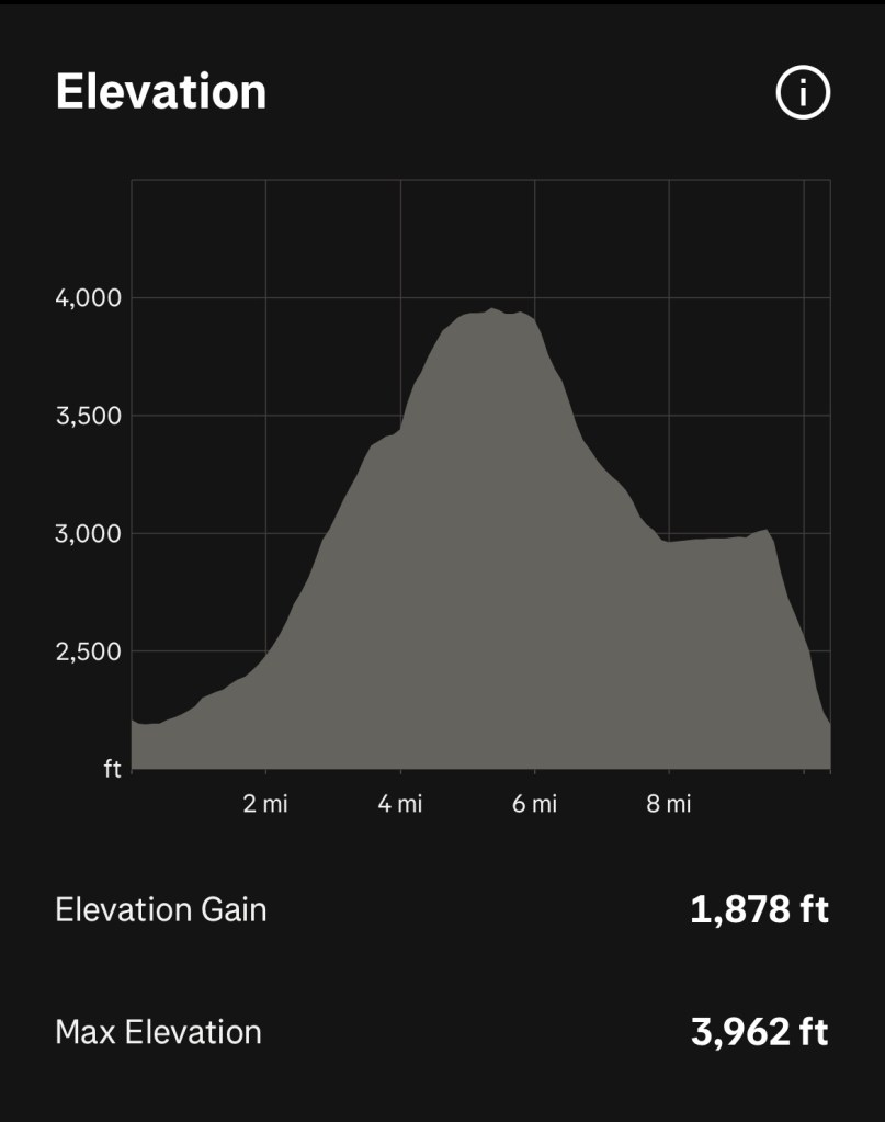
We now faced the big climb of the day with 600 metres of elevation to cover in a relatively short space of time. Fortunately we had a good path to follow and we’re both hill fit.
There were some rough, rooty sections with boulders and roots to work around, but for the most part we made relatively easy going of it, grinding it out at a steady pace.
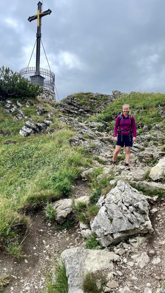
As we reached the highest point of the afternoon, the rain again began to spit. Knowing that we were so close to the cover of yet another café, Ellen broke into a run ahead of me to get under cover as quickly as possible. We enjoyed a cup of tea while waiting for the clouds to clear to expose more beautiful views of the mountains we’ve been admiring for days.
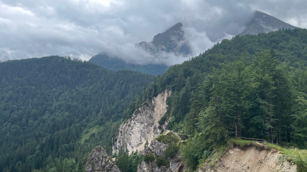
From here, the descent was definitely harder than the ascent as the path had been eroded by the elements. That aside, the gradient was such that it was a challenge. Again, slow and steady was the way to go. The views of the rock face were stunning and we could see the fixed ropes used by the climbers; sadly there weren’t any today, likely due to the weather conditions.
Down, down, down we went steeply. Remains of a landslip were evident, the path being very vulnerable to the elements.

Finally we reached Königssee, just in time for the heavens to open yet again, this time quite spectacularly! We enjoyed a well earned meal in a shoreside restaurant before the torrential rains went off and we got the bus back to our hotel.
Another great day, we’re now well into the swing of walking and are enjoying each day.
Day 7: Jenner from Königssee
This was an additional day, tagged on to allow us to relax ahead of heading home. Yesterday, an alternative option was included, based on closure of one of the trails a few years ago and this seemed like a good option for us. Our day started with the bus back to Königssee from our base in Berchtesgaden.
We then began walking around Lake Königssee before heading off on a very good track to Jenner, a mountain standing proud at 1874 metres. Our plan was to walk up and take the cable car back down.

We set off in light rain, nothing that would soak us, and with the cover of the trees we don’t notice it too much. The only downside was that the initial views were limited by the cloud.

As we progressed the sun began to break through as forecast and we were able to enjoy glimpses of blue sky. Looking back frequently, we enjoyed the views.

The climb was pretty consistent, and again we marvelled at how much easier this is on a decent path!
On and on, up and up, in total we had around 1200 metres of ascent.
We took so many photos as all around us were phenomenal views! Lacking people to take pictures for us (most heading for the summit via the cable car) we resorted to the self timer.
When we reached the steepest section of the climb, a zigzagging narrow path, we agreed this was more like a Scottish hill and we’d consider this path good when at home. It wound back and forth to take us out ahead of the summit restaurant with just a very short walk to the summit.


We couldn’t believe how many people there were when we reached the summit of the mountain! Where did they all come from? Oh, that’s right, the cable car!
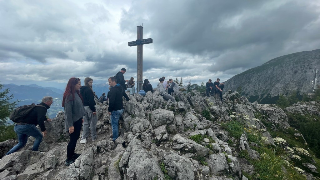

With the sky having completely cleared, the views all around were amazing!

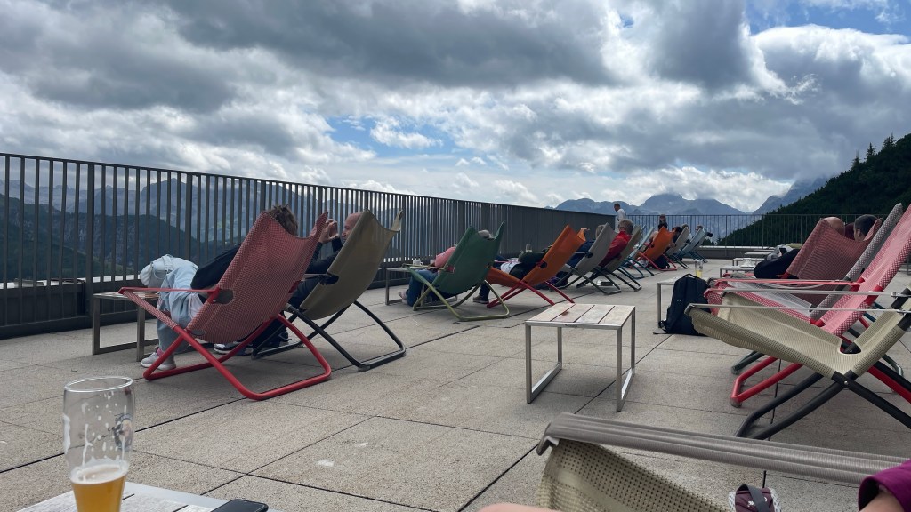
Having achieved our goal, we headed for the restaurant to enjoy our surroundings over a leisurely snack. It was chilly where we initially sat (in the shade) and I had to put on both my mid layer and waterproof jacket. Making the decision to move to the deck chairs in the sun was a good one. Here it proved very difficult not to doze off.
After a time, feeling rather sleepy, we made the tough decision to leave the summit. The cable car down was quiet so we enjoyed a car to ourselves, drinking in the last of the views.
Back in Berchtesgaden, we enjoyed a sauna and swim in the outdoor pool to round off our holiday. Absolute bliss!
Mission Accomplished
The holiday was to make memories and celebrate Ellen’s birthday. I think we achieved our goal. There was lots of laughter and I think we both enjoyed our adventure. I can only speak for myself, but I’d do it all again tomorrow if I could.
We rounded off our holiday with a night to relax in Munich, walking the city streets and watching the surfing ahead of flying home. Definitely a holiday to remember.


Nice walking adventure
LikeLiked by 1 person
That does look and sound like a fabulous adventure.
LikeLiked by 1 person